About my blog

CLL is the acronym for Chronic Lymphocytic Leukaemia. CLL is the most common cancer of the blood. However, unlike many other leukaemias, CLL is incurable. Innovative research is desperately needed to provide treatments which are more effective than the derivatives of chemical warfare agents currently in use. Research however costs money.

In 2009 I walked from John o'Groats in the north east of Scotland to Land's End in the south west of England. Hence the acronym JOGLE. The purpose of my walk was to make more people aware of this insidious disease and to encourage them to sponsor me by donating to the research groups I was supporting. It was a most enjoyable experience and I met some wonderful people. Together we raised over 2000 pounds for the cause. Thank you everyone!

In, 2010, the blog was being continued for those who may have be interested in following my walking holiday in Wales. This was not a charity walk.

Sadly this year, 2013, Alan Frost, a senior member of the Wednesday Loafers, our cancer support group, passed away. Many medics will tell you that CLL can be cured by a bone marrow transplant. Alan had battled with the cure for many years. More research is needed, but significant progress has been made since I started this blog.


CLL is still killing my friends. The organizations listed at the side of this blog would welcome any contributions you would like to make towards their research.

Please feel free to pass on the details of this site to anyone you think may be interested. The link is www.cancerwalker.com
_______________________________________________


Saturday, July 31, 2010

Recent photos

Looking North along Aberystwyth promenade

Looking South along Aberystwyth Promenade

Domen Milwyn

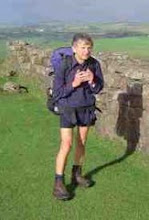
Duke of Edinburgh Group


Thursday, July 29, 2010

Wed 28 July

Bothy to Devil's Bridge

After going to bed early (around 8:00 pm) I was awakened by a loud banging about 9pm. It was a friendly farmer, Ian, delivering wood to the bothy, so I got up, dressed and gave him a hand to unload it. When we had finished I made a cup of tea and we had an interesting chat.

I left the bothy at about 9am, shortly after the group from Burton. It was ideal walking weather with clear views but no direct sunlight. It was marvellous to be able to see a route miles ahead rather than a few metres ahead like it had been on the walk up to Garn Gron. Being able to choose the terrain over which one is walking can make the going much easier.

The weather held all the way to Domen Milwyn, but it was a bit windy by the cairn. The weather closed in on the way down to Cwmystwyth, and it got much worse heading for the forest. It was very boggy underfoot, reminiscient of Brown Rigg Head, for those who know it.

I am now camped at the Devil's Bridge campsite. Tomorrow I intend taking the narrow guage steam railway down to Aberystwyth. I will then head for Torquay, to meet up with Shiel who arrives from NZ today. I've just walked about half of the Cambrian Way and may come over and do the second half next year, hopefully in better weather.

Wednesday, July 28, 2010

Tue 27 July

Pontrhydfendigaid to Claerddu Bothy.

An easy day today. I stayed at Red Lion, a hotel which is in the process of renovation. I left at about 9:30 am in very very light rain. The weather improved as day wore on, but there was very little sun so no suntan lotion or sun hat needed.

A new path has been put in on the left, just before Tyncwm Farm , removing the need to go through the farm. A new bridge has been put in to make it possible to cross the river higher up the valley.

I had a pleasant time walking up to Teifi Pools, but it was still a bit wet underfoot. I may have seen two red kites.

Got to Bothy about 2:00 pm and just spent time relaxing and enjoying a short day. After about an hour a group of 4 teenagers turned up and camped outside. They are doing their Duke of Edinburgh awards. I had a good time chatting to them.


Mon 26 July

Ty'n-y-cornel to Pontrhydfendigaid

I left the YHA in slight drizzle, which got worse as the day progressed. I had kindly been advised to walk on the ridge and keep the forest, a few 100m away, on my left. I saw the forest once for a few minutes and that was it!

Visibility was dreadfull, making it difficult to avoid rough boggy ground, or find the path. It was all compass and gps work. Being alone, unable to see any distant land features, it was reassuring to at least know where I'd got to on the map. I was relieved to find the road near Nantymaen. Sadly the phone box had been badly vandalised and was unuseable.

I then rejoined the battle and set off to find Garn Gron. I had to get within about 30 m of the summit before I could see any cairn or the trig point. So much for the extensive views. It was only around 3:30 when I was nearly down off the moor, near the road, that it started to clear.

It was a very pleasant evening but a very hard day. I had made a really good job of drying and polishing my Scarpas before I left the YHA, but they are saturated again. I can remember one similar bad rainy day on the Pennine Way when it took me 10 hours to get from Edale to Crowden . Todays walk was only about 8 hours but there was no steep climbing involved just very rough terrain.

Monday, July 26, 2010

Garn Gron


Grotty visibility on Garn Gron!--

Sun 25 July

Rhandirmwyn to Ty'n-y-cornel YHA

It rained overnight, but by the time I left at 9am the tent was almost dry. Breakfast was chocolate and a muesli bar. A lovely walk up the Doethie Valley gradually climbing into better weather. A very clear track, compared to yesterday, but sometimes a little boggy. As I had been unable to get any sense from the YHA, after numerous phone calls, or visiting the web site (today) I didn't know what to expect. It turns out they had plenty of room in a great location. The hostel is privately owned now and I arrived just as a meeting of the trustees was coming to an end. I had a very pleasant evening in the company of Nigel, who is currently duty warden.

If you are walking the Cambrian Way, or would simply like an overnight walk from the C&CC site at Rhand.. this is a geat spot to choose. A good way to introduce your family to the pleasures of walking and hosteling.

Sat 24 July

Talsarn to Rhandirmwyn

Nice quiet campsite for only 5 pounds, but no evening meal available at pub (Red Kite). Showers at site under renovation. I left the campsite just after 8am and headed by road to Sarnau, and thento Myddfai, where I picked up Tony Drake's route. I got lost trying to find way into wood above Llandovery, where I arrived a little after 12. I did some shopping then headed off on my own route to Rhand, via the river Towy. I thought it would be easier!

I found some 'rights of way' blocked by head high nettles and blackberry. I was wearing shorts and got very badly scratched and nettled. I washed arms and legs in the river but forgot about my face, not being able to see it. There was sufficienr blood running down the right side of my face that it caused a women to cry out in shock when she saw it near the campsite! I didn't see it until I was having a shower at the ccc site. If I had seen it earlier I would have blogged it. It looked much worse than it was. The worst problem was the pain and irritation from the nettle stings. I had a good ostrich steak in the pub but it is up quite a hill from the ccc site.

Saturday, July 24, 2010

Fri 23 July

Glyntawe to Talsarn

Had breakfast at the Cave Cafe, but it was not ready before about 9:30 rather than the 9:00 quoted.

It was a hard but very pleasant climb beside the river up the east side of Fan Hir. I was a bit worried what the climb up on to the ridge would be like just near Llyn Fan Fawr, but it turned out not to be too bad. There was then another hard pull up to the top of Fan Brycheiniog. I shared walking experiences on a little of the route, with a couple out walking for the day. They offered to take photos of me so I have proof I reached the top!

The walk down to Llyn y Fan Fach gave me one of the best all round views I've ever experienced in the British Jsles, simply magic.

The couple mentioned a farm selling puppies and they suggested I should query if they were doing teas today. They weren't but they said they would! I got a pot of tea and carrot cake in a beautifully peaceful farm garden. I had a most interesting chat with the couple running the farm and cafe.

The cafe is called, not surprisingly, The Farmyard Cafe. Kathrin Hofer, ran the cafe and said they sometimes allow campers to stay overnight. There are toilet facilities but no showers. She also mentioned the possibility of an evening meal being available. As the pub (Red Kite) at Talsarn closes now at 5:00 pm this could be a useful resting place for a Cambrian way walker. Contact details:- kathrin.hofer@ymail.com


I am currently at the campsite at Talsarn, good showers [50p] but no food available locally after 5pm.


Thursday, July 22, 2010

Just a note of caution regarding compasses

Because of dip angle effects I bought a new compass in the UK rather than trying to use my NZ compass. Last night when pitching camp I wanted a clear line of sight to the morning sun to dry the tent. I took out my compass. According to my compass East was in the wrong place, just about where the sun was setting! Low cloud hid the exact location. MY COMPASS IS NOW MAGNETISED 180 DEGREES OUT OF ITS ORIGINAL ALIGNMENT! I remember things didn't seem right getting off Fan Gyhirych and I resorted to checking wih gps. Because of the remagnetisation the weight compensation, to balance the dip effect, is also now in the wrong direction. The compass now sticks! I kept my cell phone and compass in the same jacket pocket for a while and l think that is when the remagnetisation must have taken place.

I have now narrowed down the compass problem to the case I bought for the cell phone. It is held shut by a powerful magnet! Beware Paul as I think you have the same sort of cell phone case!

Thu 22 July

I dad a rest day today. I went looking around the Dan-yr-Ogof Caves. One of the longest cave systems I've walked in. The weather was mostly dry and sunny, but for a short period of rain about 4:00 pm. Tomorrow l head over Fan Hir and Fan Brycheiniog. I will camp or stay at the YHA depending on availability.

A summit

Chartist's Cave

Cliffs above Llangattock


Wednesday, July 21, 2010

Wed 21 July

YHA near Storey Arms to Glyntawe.

Good breakfast at YHA at 7:30am, after a very good meal the previous evening. I didn't manage to set off walking until 9:30 am. I had a very scenic but hard climb on to the moor with pretty uneventful navigation to the road. However, I didn't see any standing stones, but met the road just where the track took off almost direct to Fan Gyrich. It looked a bit vertiginous but there was a barbed wire fence between me and the drop, and close up it looked less hairy than at a distance. I was overtaken continuously by army personnel out training,

Yesterday they were camped at the top of Pen-y-Fan, today I met them at the top of Fan Gyrich. The weather was much nicer today though! I got slightly lost making my way to the campsite at Glyntawe. A really well laid out site with a good pub nearby, The Gwyn Ams. I've just had a very good sirloin steak which should boost my Hb level.

I am taking a days rest at Glyntawe tomorrow to recharge my batteries, and to visit the caves nearby.

Tue 20 July

Wild camp to YHA @ Llwyn-y-Celyn.
Got up after 7:00am and the rain was easing after pretty heavy rainfall overnight. I had the muesli I bought in the camp shop for breakfast, but it was not very nice. Everything was damp but I managed to strike camp in only low cloud rather than heavy rain. Visibility was about 100m.

I set off aross the moor using gps way-points, and by and large I was able to find a path going in my direction, l eventually met up with road but didn't see the huge army lorries parked there until I was within about 30m of them! In view of the poor visibility I climbed Pen-y-Fan via the more gradual old roman road.

I was passed by soldiers going up Pen-y-Fan, and made the mistake of following them for a while. Unfortunately they had veered from my route. It was hard work getting back on track. The weather was atrocious. Two-thirds of the way up I met a group of Duke of Ed. students who had decided to call it a day. I carried on and eventually reached the Storey Arms. There is a refreshment van their! Reputedly open every day but Christmas Day.

Just then the heavens opened! I decided to make for the YHA which turned out to be an excellent decision. I met a couple called Nick and Louise Carter and she recognised me by the fact that my accent was similar to that of Mike McGowan, who they knew and who I was at school with 50 years ago. A very happy ending to a pretty miserable day

Sunday, July 18, 2010

Sun 18 July

I spent the day in Crickhowell recovering. I had the largest breakfast I have ever had, for £5, and then went back to the tent to sleep it off. I am now in the information centre using the Internet. It's nearly 5 pm and I'm just starting to feel as though I can set off again tomorrow. There will probably be no posts for a while as I am thinking of taking 2 days to get to Glyntawe, via the Storey Arms, with 2 wild camps on the way.

I am now returning to the campsite to clear my backlog of washing.

Photos


Saturday, July 17, 2010

Sat 17 July

Did I suggest yesterday was hard? Forget that. Yesterday was easy. Today was hard! (For my scientific friends that is what we call a re-calibration.)
I had a great evening meal at the Grange in Capel-Y-Ffin amongst very good company, not walkers this time but horse riders. The conversations would have been completely unintelligible to me but for my almost daily visits to Hutt Valley RDA.

I got a breakfast for 8:00am but was delayed polishing my boots etc. It was well after 9:00 by the time I left the Grange. By the time I had rung Shiel (my wife) from the phone box opposite the Capel, (of -y-Ffin fame) it was about 10:00 am.

Instead of taking Tony Drake's route up the valley I took a very steep, but clear path straight onto the end of the ridge fron where it was a gradually sloping walk to Twmpa. The way underfoot was reminiscent of walking the Pennine Way above Edale.

At the top I had a chance neeting with two blokes, Brian and Ian, out on a day walk from Merthyr. Photographs may hopefully soon appear. We had a great time chatting while we walked along, putting the world to rights, and it made the climb to Waun Fach much easier for me. They left me on the walk to head down to the Grwyne Fawr reservoir. I thought I had done most of the climbing by then so I was in for a few surprises. The days had started with terrible wind and rain but gradually got better as the day wore on, but the cross wind was always pretty fierce.

To give credit to Tony Drake, today's walk must be one of the best ridge walks in Britain. If you are only carrying a day pack. However with a full camping pack, and I'm not a light packer, it was very hard work. I reached the campsite after 9 hours, absolutely knackered! Mind you it is possible some of the fatigue and sweating I have suffered since the walk might have other causes. However the 'mother node' in my neck was smaller than it's been for 20 years, after the walk.

The campsite in Crickhowell is an excellent walkers campsite but you have to be over 18 years old.

Fri 16 July

It was about 9:15am by the time I left the B&B. By the time I had bought a compass suitable for the northern hemisphere it was about 9:45am, and by the time I eventually found the correct road leading to sugar loaf it was nearer 10:00!

The navigation to the top of Sugar Loaf was uncomplicated but the steep track, especially near the summit, was hard work. I only spent a few minutes at the top as it was clear rain was heading in. There were a few people up there and one group offered to take a photo of me by the trig. point. I checked my way off Sugar Loaf with someone on the summit and then made an uneventful trip down to Forest Coal Pit. I made a phone call to my B&B to tell them I was running late.

I stopped at a farm, on the way up to Garn-wen, to take on extra water and had a very enjoyable conversation with a farmer and his wife. I positively sailed up the next few km. It made me realise that meeting interesting friendly people is more important to me than extensive views from a mountain ridge.

After leaving the farmhouse the route was well defined and almost became a 'motorway' when it joined the Brecon Way. I met a large group of school children doing their Duke of Edinbrough walk, near where the Brecon way turned down East. The weather deteriorated to periods of howling wind and rain interspersed with bits of sunshine. I met a chap who said I would have to walk down over the moor to Capel-y-Ffin but I eventually found a pretty clear path down, starting at a large cairn.

When tired at the end of the day going steeply down hill is nearly as bad as going up

Friday, July 16, 2010

Thu 15 July, Pontypool to Abergavenny

I left Ty Scon Jacob at 9:30am and found a quiet path down to town, via a reputed Old Roman Road and a short path through the forest. I the went up a very quiet country lane to meet up with Tony Drake's route a few hundred yards past the folly. A bit tricky finding the route across a river, behind a farm but after that it was simple contour walking just to the east of the ridge. I had extensive views, and it was quite windy, but at least the morning rain had cleared. I lost the track about a mile or two from the road and it was very hard going underfoot until I picked it up again. I stopped to rest at the road crossing and met up with 4 men out walking for the day. After moving off, one of them, a fellow Yorkhireman, came back to tell me that I should turn off the road onto the path at a small horse trough. That was very useful information and I had a long, if uneventful climb, up to Blorenge. The first part of the descent to Abergavenny was well marked. Then I followed a long tricky descent through high bracken before I eventually found the path which leads down to a tunnel under the canal. Walking down Blorenge was harder than walking up!

Thursday, July 15, 2010

Wed 14 July, Lower Machen to Pontypool

I stayed at The Forge B&B in Lower Machen, which I reached via Draethen. There was a very nice pub in Draethen, good atmosphere, and a pint of Guinness with a cajun chicken with salad and boiled potatoes cost less than 10 pounds!

The landlady at The Forge suggested two ways to get up Mynydd Machen. I took the JOGLE version, a nice quiet coutry road up to join the Sirhowy Valley Walkway, which took me all the way to the top of Mynydd Machen, in fine weather. The path down through the forest at Risca appears to have been blocked by bulldozed trees, whether by accident or design, I am not sure. Local ramblers might be interested in the changes. I had a pleasant walk through the sports ground in Risca where I met two blokes, my age, who I asked about restaurants. They suggested a little cafe on the canal, just metres off the road up to Twmbarlwm.

It started to rain whilst I was in the cafe and continued intermmitantly until I reached the parking area just before the last steep pull for the summit. The path along the ridge was clearly defined until about 700m from the Blaen Bran reservoir where I lost the path in the long bracken. I eventually found a path to the reservoir and then headed to my B&B at Ty Shon Jacob farm via Upper and Lower race. The farm is about 300m above the town of Pontypool so I didn't bother making an extra trip down to a pub for a meal. It rained heavily, on and off, all night

Tuesday, July 13, 2010

Cardiff Photos

Tuesday July 13, 2010

I caught a bus to Cardiff Castle fom just outside my hotel, The Tane, arriving at 8:30am on a dull and overcast morning. Good walking conditions initially. I walked up the east bank of the Taff river. Just before the turnoff to the canal I met up with the snail I met last year on my JOGLE. He's obviously making better progress than I expected!

Shortly afterwards I met up Glyn Brewer, and he acted as my guide to just before Tongwynlais. He used the Taff trail, which appeared much simpler than the canal route in the book. It was an interesting encounter and Glyn was very knowledgeable about the history of the region. The time flew by.

I soon arrived at Castell Coch and then climbed on to the Rhymney Valley Ridgeway. I followed the standard route to about 1 mile past Rudry when l diverted, via Draethen, to my B&B, The Forge, at Lower Machen. l went back to the pub in Draethen for my evening meal. A Guinness and cajun chicken with salad for just under 10 pounds. The rain was not too unpleasant until just after Rudry and it had cleared up again in time for my trip to the pub.


The Snail making steady progress

Monday, July 12, 2010

The beginning

Well after a long period of dry weather the rain has started, just as I set out for Cardiff by train. I will soon be on my walk.

Tuesday, July 6, 2010

Mr. Bean Goes Walking in Wales.

The title above is in deference to my former colleagues on the RV Tangaroa but it is already becoming too prophetic for comfort. I am planning a walk on part of the Cambrian Way. In the process I was trying to find accommodation at a campsite near Talsarn. I made contact with a very pleasant lady at the campsite and pointed out the uncertainty in my arrival date due to walking a long way on foot. She said there would be no need for me to book as a single person tent could be easily accommodated in an emergency. I then went on to inquire as to where I could get an evening meal. She suggested the pub in Talsarnau. I took this to be some kind of local name for Talsarn. However my suspicions were aroused when in a later e-mail she suggested that failing the pub being open I could always order an Indian take away from Harlech.

Now my knowledge of Welsh geography is slim at best but I knew that in planning my route I had never come across the name Harlech. On checking I found it is more than 100km from Talsarn! However, not surprisingly, Harlech is very near Talsarnau, which also has a campsite.

I think for me (or even Mr Bean) this is a record. This year I've managed to get lost before the walk has even started.