Summary
Today’s distance: 23.4 km (14.5 miles)
Total distance: 1420 km (882 miles)
Distance to go: 208 km (129 miles)
Report
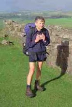
We had breakfast at the B&B in Merton at 7:30 am and Shiel deposited me at the cross roads at North Town by 8:30. I headed west along what was at first a busy road but after 9:00am there was an appreciable drop in traffic. I took a path through a wood near Filleigh Moor, to cut off a corner, and continued to Shebbear where l found a small local store open. I was able to buy two orange drinks.
Just before Shebbear l had met two heavliy laden cyclists and had asked where they were headed. They were heading for John o'Groats via Wales and lreland, before taking a ferry to Scotland. We compared notes before heading our separate ways.
From Shebbear l continued west, first via a very boggy path and then via a quiet minor road to Oxenpark, where l then headed south west towards Woodacott and then Holsworthy. I arrived at the A388, 1km north of Holsworthy, just after 1:00pm and found Shiel waiting. We arranged to meet up again near the church and then go to lunch. On closer inspection however l found there were two churches so by the time we eventually met up in the centre of Holsworthy it was 1:50pm. We went to a small cafe for a cream tea each but had to make do with one between us as they only had two scones left. We parted in Holsworthy at 2:55pm with the arrangement that l was to walk to the bridge over the Tamar on the small minor road about 2 miles north east of Whitstone. I made better time than l expected and was there by 4:30pm.
We both then travelled by car to our B&B in Hopworthy where l had a good soak in the bath before we headed for an evening meal at the pub in Pyworthy. To get to Wainstone Corner, the original end point for tomorrow, would only be 12km. However l intend re-routing slightly. I plan to walk to Whitstone and then head for Middle Wheatley. I then drop off the edge of my map! Following a road atlas, 1:250,000, l plan to head roughly south to South Wheatley and then south west to Canworthy Water, where l will again get back on my map, meeting my old planned route about 0.5km south of Trelash. I then plan to continue on towards St. Mabyn stopping at some convenient location l reach between 4:00 and 5:00pm.
About my blog
CLL is the acronym for Chronic Lymphocytic Leukaemia. CLL is the most common cancer of the blood. However, unlike many other leukaemias, CLL is incurable. Innovative research is desperately needed to provide treatments which are more effective than the derivatives of chemical warfare agents currently in use. Research however costs money.
In 2009 I walked from John o'Groats in the north east of Scotland to Land's End in the south west of England. Hence the acronym JOGLE. The purpose of my walk was to make more people aware of this insidious disease and to encourage them to sponsor me by donating to the research groups I was supporting. It was a most enjoyable experience and I met some wonderful people. Together we raised over 2000 pounds for the cause. Thank you everyone!
In, 2010, the blog was being continued for those who may have be interested in following my walking holiday in Wales. This was not a charity walk.
Sadly this year, 2013, Alan Frost, a senior member of the Wednesday Loafers, our cancer support group, passed away. Many medics will tell you that CLL can be cured by a bone marrow transplant. Alan had battled with the cure for many years. More research is needed, but significant progress has been made since I started this blog.
CLL is still killing my friends. The organizations listed at the side of this blog would welcome any contributions you would like to make towards their research.
Please feel free to pass on the details of this site to anyone you think may be interested. The link is www.cancerwalker.com
_______________________________________________
_______________________________________________
Subscribe to:
Post Comments (Atom)

No comments:
Post a Comment