About my blog

CLL is the acronym for Chronic Lymphocytic Leukaemia. CLL is the most common cancer of the blood. However, unlike many other leukaemias, CLL is incurable. Innovative research is desperately needed to provide treatments which are more effective than the derivatives of chemical warfare agents currently in use. Research however costs money.

In 2009 I walked from John o'Groats in the north east of Scotland to Land's End in the south west of England. Hence the acronym JOGLE. The purpose of my walk was to make more people aware of this insidious disease and to encourage them to sponsor me by donating to the research groups I was supporting. It was a most enjoyable experience and I met some wonderful people. Together we raised over 2000 pounds for the cause. Thank you everyone!

In, 2010, the blog was being continued for those who may have be interested in following my walking holiday in Wales. This was not a charity walk.

Sadly this year, 2013, Alan Frost, a senior member of the Wednesday Loafers, our cancer support group, passed away. Many medics will tell you that CLL can be cured by a bone marrow transplant. Alan had battled with the cure for many years. More research is needed, but significant progress has been made since I started this blog.


CLL is still killing my friends. The organizations listed at the side of this blog would welcome any contributions you would like to make towards their research.

Please feel free to pass on the details of this site to anyone you think may be interested. The link is www.cancerwalker.com
_______________________________________________


Monday, August 30, 2010

Day 19. Sodom to Prestatyn.

Preamble: Over the last two or three days, at times, I've had difficulty getting my leg over. Even Shiel commented on it. I think it is something of which the Offa's Dyke Association should be made aware. Although most stiles have steps of sufficient height that one's boot reaches over the top board on the stile, the stile is sometimes too narrow to accommodate the length of leg from knee to boot. This results in an unstable crossing of the stile when one's boot hits one of the upright supports. The stone stiles on the last day, although of interest in their own way, were particularly plagued with this problem. This is not a trivial matter. Our landlady a few days ago told of one group that had to abort their walk because one of their party broke an arm whilst attempting to cross a stile.

The Walk: We had an early start, 8:40am, in clear but cool weather. I was wearing my polypro for the first time. We started to climb shortly after leaving our B&B (Fron Hall), and within about 10 minutes I decided I also needed my windproof jacket. We had good views back over yesterday's route at this time.

It was a good pull to the top of the hill, Cefn Du, and I was glad we stayed at Sodom and not further down the hill in Bodfari. Climbing out of Bodfari to Cefn Du on a full stomach does not bear thinking about.

Just as we reached the summit the skys darkened, the rain came and the wind intensified. We put on all our wet weather gear. Needles to say, what might have been extensive views were seriously curtailed. The wind rose to almost frightening proportions and in crossing one field, near Rhuallt, we heard an almighty crack and saw a large branch break off an oak tree. Fortunately it was about 30 metres away. By midday the rain eased and the views improved but the wind was still horrendous.

The route into Prestatyn is quite imaginative, and climbs high above the town giving great views out to Snowdonia, and north to Lancashire, but we spent most of our time trying to keep upright in the gusting wind. As Shiel said, 'Now we know why they've sited a wind farm offshore here.' Fortunately the wind was blowing us onto the hillside, and not off it or the walk would have been impossible. On a calm day it must be a really impressive end to the walk. Full marks to the planners.

Having now done the walk I would recommend a south to north crossing to anyone contemplating the walk. Finishing in Sedbury would I think be an anticlimax compared to finishing in Prestatyn.

As we passed our B&B we popped in to report our progress, but continued, fully kitted, to the water's edge in Prestatyn. It was still very windy and it felt like one was in a sandblasting machine. We didn't hang around but took a few photographs and then returned to our B&B (Plas Ifan Chapel. Plas Ifan also have camping facilities and will even provide a breakfast if requested. We met two young guys there who had had great difficulty finding a campsite in Prestatyn until a publican had referred them to Plas Ifan Chapel.


This one is for Graham at RDA. It might help place where we are.

Monday. Walk over. Where are we? Here is a clue.

Shiel st the end of her first long distance walk. Note the smile!


Sculpture on the beach at Prestatyn.

Sunday, August 29, 2010

Day 18. Esgairlygain to Sodom.

Preamble: The pub in Llangynhafal was taken over with a Cancer Charity event so we were taken to the next pub down the road for an evening meal. Not a bad meal, but not nearly as good a value as the pub at Llandegla. On returning us to the b&b the owner was going to feed his horses so I asked if I could go along too. A pleasant way to round off the evening.

Walk: We left Esgairlygain at 8:40 in fine sunny weather. The climb back onto the ridge was not too steep, and we were on the tops again in an hour. We still couldn't find the path down, shown in green on the OS map, at the top end of the route near the finger post. The way down seems to use the much fainter dotted path on the map. Not far rom the top though the path, when found, is clearly marked.

It remained clear but windy, and we had excellent views from the ridge. There were quite a few people out walking, mainly sourced from the two car parks we passed along the way. We did however meet two Offa's Dyke walkers, Chris and Graham, walking the path in aid of NSPCC in only 10 days. I thought that I was a heavy packer but Chris makes me look like a light packer, he was carrying 60 lbs.

There were many ups and downs to hill forts and it was a great walking day, if a little cool. We had one hard shower on our descent into Bodfari where we had a snack outside the shop. We had been told, incorrectly, that the pub wasn't open. There then followed a short, but steep climb to Fron Haul our b&b.

We went down to the pub for an evening meal and were offered a lift back, but we decided to walk. Without our packs it was a pleasant walk back. I think even Shiel may have enjoyed our penultimte day.


Chris & Graham

The frame has snapped on my Osprey rucksack!

Friday, August 27, 2010

Day 17. Llandegla to Esgairlygain (Llangynhafal)

Preamble. Last night we stayed at The Hand b&b in Llandegla. They very kindly ran us to the nearest pub, The Plough, for our evening meal. We each had an excellent meal at a remarkably cheap price. Service was good and the pub is well worth a visit if you are staying in Llandegla. We walked back from the pub to the b&b in about 15 minutes.

The breakfast at The Hand this morning had to be the most imaginative of the trip and we've had some good breakfasts. Fresh fruit followed by salmon and scambled egg and finishing with pain au chocolate, toast, coffee and honey.

The Walk. Today we were casting shadows fom our first steps. A sunny day all day. We crossed mainly flat farmland to start with before gradually climbing up towards Moel y Plas. We then skirted around Moel Llanfair with great views to the west. We then skirted Moel Gyw before coming down to the busy A494.

A climb to Moel Eithinen was followed by a climb to Foel Fenlli, but this hill fort was skirted rather than fully ascended, but great views were had along the way. We then descended to a very busy carpark at Bwlch Penbarra. Remember today is bankholiday Friday. We then had a 2 .8km climb to the summit of Moel Famau, the highest peak in the Clwydan range. The climb was pretty gradual but for the last few metres (horizontal). At the top, there were great views from the Jubilee Tower in all directions. We could see Snowden, Liverpool and Jodrell Bank amongst many other well known landmarks. It turned a little cool on top so we donned our windproof clothing to walk north along the ridge before our descent to Esgairlygain. Finding the path down from the ridge was not a trivial task but we reached Esgairlygain by 5 pm having left Llandegla around 9am.

Swing bridge on Llangollen canal.

Were you hoping to cross here?

Eglwyseg crags.

Path repair work by Denbighshire council. Note the wheelbarrow!

Day 16. Froncysyllte to Llandegla.

Preamble: Last night we stayed at yyyy a b&b right on the path just before Froncysyllte, and the Llangollen canal. We had an excellent meal and a good chat with Pat and Malcolm our hosts. A great place to stay and they will even do your washing. Another good reason to use our 3 day route choice from Llanymynech to Llandegla.


Today's walk: It was the best of days and the worst of days. For the first time we wore our waterproof clothing all day. The rain was only heavy a few times but the drizzle was persistant. We never saw our shadows once.

That having been said I think today was probably the most impessive day's walking we've had so far. For those who have walked the Pennine Way it was a combination of High Cup Nick and the Swaledale walk from Thwaite to Keld. Magnificent scenery even on a wet day. On a sunny day it must be incredible.

The day started with a pleasant walk along the Llangollen canal. We then joined the road to go to the bridge over the Dee from which one can get a very good view of Thomas Telford's aqueduct, built in 1805.

We then had a long but gentle climb to the road from which there were good views of Dinas Bran and the Dee valley. The road walk was about 3 miles, but we only met one car on the walk. We then walked on north, on the scree, beneath the Eglwyseg crags. Probably the most exilharating part of the walk so far.

On the path we met a group of 'Offa's Heroes' who were maintaining the path for the Denbighshire council. They had managed to get a wheel barrow where we had had difficulty just getting ourselves down.

We rejoined the road, in heavier rain to climb onto the moor. We eventually turned off the road to cross the moor to a pine plantation through which we descended to Llangedla, and Hand House our b&b for the night.

Wednesday, August 25, 2010

Day 15. Quarry Farm to Froncyscyllte.

Preamble: In the guide book the recommended route is shown from Llanymynech to Chirk Mill at 14 miles, and then from Chirk Mill to Llandegla at 15.5 miles.

As Shiel is new to walking I have tried to limit our walking days to less than 12 miles. We will therefore take 3 days to get from Lanymynech to Llandegla. Shiel also likes visiting castles and with our choice of route we were able to spend 2.5 hours today looking around Chirk Castle.

Today: As we were having a short walking day we didn't order breakfast until 9:00am. As a result it was after 10:00am before we bid goodbye to Beryl and Peter after a very enjoyable chat over breakfast.

The day was overcast but there was no wind or rain and we had a pleasant 3 hour walk to Chirk Castle. We looked around the castle and gardens for over two and a half hours and even had time for tea. I would recommend our route choice to all walkers who are more interested in seeing the UK than getting from Sedbury Cliffs to Prestatyn in record time. Our route also allowed us to visit some great b&b establishments.

We arrived at Chirk Castle on a permissive path and attempted to leave on the same path. However, unbeknown to us there is more than one permissive path at Chirk Castle, and we picked the wrong one! We eventually realised our mistake, but we had walked about an extra km as a result. We arrived at our b&b, Cloud Hill, at 4:30 pm. Two and a half hours later we had an excellent evening meal cooked at the same establishment.

Tuesday, August 24, 2010

Day 14. Llanymynech to The Quarry, Selattyn.

We left the b&b at around 9am and headed for the post office where I got a £20 voucher for my 'orange' blog-o-phone. We were delayed slightly, first by Shiel having water leaking from her pack and secondly by me deciding to polish the toes of my boots. I think the technical term for these procrastinations is;- 'a faff.'

It was sunny but very windy when we eventually left Lanymynech around 9:30am, and started our ascent of Llanymynech Hill. There were good views of interesting rocky outcrops before we finally arrived at the golf course. Whilst rain threatened it held off all day and we never needed our waterproof clothing. The first ascent of the day though, over Llanymynech Hill, was marred by the overpowering smell of slurry borne in on the blustery wind. However, by the time we reached Porth-y-Waen the air had cleared significantly. Then we followed a road walk to Nantmawr, and a climb through woods (Jones's Rough) to the top of Moelydd where we had extensive 360 degree views. There seemed to be a lot of rain on the horizon, especially out west, but we escaped it.

We headed down for lunch in Trefonan, where a dead tree has been skilfully carved in the shape of an eagle. The final climb of the day was up though Racecourse Wood where we met up with Bill and Peter who are walking Offa's Dyke in stages over a number of years. We had passed them earlier in the day in the company of their wives, Jill and Susan, who had now travelled on ahead to pick them up near the car park at the old Oswestry Racecourse.

We had a good chat with them, whilst climbing to Racecourse Common, which made the climb so much less tiring than we had feared. We stopped at a plane table near the racecourse ruins, but all the views are now obscured by new tree growth. Then there was an easy walk to our b&b, The Quarry, near Carreg-y-big.


Black eyed sheep. Black ears, nose and feet.

Monday, August 23, 2010

Day 13. Welshpool to Llanymynech.

Started walking north by the canal to meet up with Offa's Dyke path. We spent the first two hours taking waterproofs on and off in the intermittent rain. The rain then eased and we had a clear run until two minutes before we arrived at the b&b.

The route was mainly flat walking over farm land following a river stop bak, and the eventually Offa's Dyke. A lot of concentration was needed to avoid treading in cow pats or sticking the walking poles in them. We saw three families of swans one pair having seven cygnets.

There were plenty of ripe blackberries along the route and at one point a landowner was giving away apples to passing walkers.

As it was a short day we stopped for lunch at the Golden Lion in Four Crosses to pass the time.

Day 12 Welshpool.

Beautiful sunny day sightseeing in Welshpool.

We walked to Powis Castle and spent the afternoon looking around the castle and gardens. A really enjoyable visit. If you are walking Offa's Dyke it is well worth taking an extra day to visit the castle and gardens.

In the evening we had a very good meal in the Royal Oak.

Powis Castle.


Swans with young on Montgomery canal

Sunday, August 22, 2010

Day 11. Montgomery to Welshpool.

The day started in sunshine with a walk past the show ground where people were making preparations for the annual Montgomery show. It looked like being a good day.

We quickly joined the Offa's Dyke path and headed north. We had fine weather for two hours, until we were just starting to climb, when the rain started and continued on and off for the rest of the day. We were well soaked, but the rain did ease slightly as we reached the top of Beacon Hill, and we even managed to get one or two photographs, but visibility was limited. However we were able to make out Powis Castle just south of Welshpool.

At Buttington Bridge we turned South to pick up the path beside the Montgomery canal to Welshpool and our b&b. We were then at last able to remove our waterproof clothing. However 24 hours later, as I write this, our boots are not yet dry enough to take polish! Not one of our better days.


Rabbit or badger damage to Offa's Dyke?


Offa's Dyke.


Road sign seen near Montgomery show ground


Amusing sign seen near Welshpool


Offa's Dyke path? (Just before Buttington Bridge)

Saturday, August 21, 2010

Day 10. Springhill Farm to Montgomery.

It rained heavily overnight and was still raining slightly when we descnded into Newcastle on Clun. There the followed a steep climb up Craig Hill in rain, and with limted visibility. A descent followed into a small river followed by a climb up Hergan before a descent again to Churchtown. The rain was still falling, but the greatest torment at this time was the remarkable number of houseflies or something similar following us in clouds. Both Shiel and I had a personal halo of houseflies. Rained continued and tormented us as we climbed upwards again, this time up Edenhope Hill, but again the visibility was limited. It was like looking at the world through a grey filter. Then we descended again, this time to the river Unk before our final climb of the day up to the Kerry Ridgeway.

As we decended to Montgomery the weather improved and it was sunny by about 4:30 when we reached our B&B. We were greeted with a welcome pot of tea and two generous portions of apple and pear cake. Probably the hardest day and the least enjoyable condtions so far.

Day 9. Discoed to Newcastle on Clun.

We started off on an overcast, but fine morning, leaving Gumma Farm at 8:45am. After a short road walk we were able to pick up a path which led to the Offa's Dyke path, joining it near a Baptist Church. This church, like two churches passed earlier on the route, stated it provided refreshments for walkers and access to toilet facilities.

Then we climbed onto the moor wih great views in all directions, and eventually descended into Knighton arriving about lunchtime. We posted the guide book for the southern section of the walk to my sister, removing 0.25kg from my back. We passed the library, on the way to the Offa's Dyke centre, where you can get access to the Internet. Then followed a pleasant walk by Teme river before a steep climb up Panpunton Hill. Great views and a stiff breeze, which seved to keep us cool on the climb. We passed a cairn raised to the memory of Roy Waters who was one of the campaigners for the Offa's Dyke path.

We had lunch sitting on Offa's Dyke looking down on the viaduct at Knucklas. There was a final descent to Garbett Hall followed by a very steep ascent Llanfair Hill. During this final ascent the rain started and worsened as we approached our b&b at Springhill Farm. Today's walk had some of the best views off Offa's Dyke seen so far.

However the highlight of the day for Shiel was being able to watch Liverpool beat their Turkish opponents 1 : 0 in the Europa cup. (We have a TV in our room at the b&b.)

Thursday, August 19, 2010

Day 8. Gladestry to Discoed.

The day started with a steep climb in clear weather onto the Hergest Ridge. There were panoramic views into England and Wales most of the way to Kington. One anomalous feature was a group of monkey puzzle trees high up on the ridge. We saw sheep today, but no horses running free. We had morning tea in Kington then set off in the wrong direction through town. We soon realised our error and set off on our second climb of the day to the highest golf course in England, on Bradnor hill. Our climb continued and we rejoined Offa's Dyke after 54 miles without it.

There was another descent followed by a climb before our final descent into Discoed, and our deviation to our B&B at Gumma Farm.

As the famer's wife had a dinner engagement the farmer very kindly ran us into Prestigne to get our evening meal, and picked us up afterwards. The retaurant had a strange name, something like The Hat Box but they provided good food and drink. We partiularly liked their tapas starter.

We were very lucky with the weather as we could see rain at times all around us but we never needed to change into our waterproof clothing. A good walking day!

Photos

Horse on the common.

Monkey puzzles on Hergest Ridge.

Flowers for Martin to identify.

Wednesday, August 18, 2010

Day 7. Hay on Wye to Gladestry

I was looking forward to today's walk along the edge of the Wye, having seen the magnificent view from the bridge, but I was to be disappointed. The walk was all through trees with scarcely a sighting of the river. It was overcast and very calm and we were tormented with flies, especially as we moved onto farmland away from the river.

It began to rain just before we started the climb from the river, but had stopped by the time Shiel had managed to get her waterproof overtrousers on. The weather got better from then on and for most of the rest of the day we were in bright sunshine. The walk continued through woodland and then along roads with high hedges, reminiscent of my walk in Devon last year.

The view started to improve about 2 miles south of Newchurch and was excellent over Disgwylfa Hill. Great views in all directions.

The hill was heavily stocked with sheep and there was little grass left, but plenty of sheep faeces. It was difficult to see how a sheep could eat grass without eating its own or a companion's excrement. The situation was pretty similar on the common below Hay Bluff, in some areas, the aroma of sheep urine was almost suffocating. There were also a few horses and ponies on the common.

As we arrived early in Gladestry we popped over to visit the church. A beautiful and peaceful building with some features dating back to the13th century.

We are staying in the Royal Oak which means we only have to walk downstairs to get our evening meal.

Tuesday, August 17, 2010

Day 6 Hay on Wye

Today was a rest day to look around the shops in Hay on Wye. First though there were chores to do. We went to the laundrette to do our laundry and while we were waiting we went to the information centre where I downloaded the rest of the Offa's Dyke accommodation guide from the internet. We then walked around the shops. Hay is a bit too busy for me during the day but in the evening and early morning it is very pleasant. Our b&b is also a bookshop so there is no shortage of reading material. Tomorrow we are heading for Gladestry.


Monday, August 16, 2010

More Photos

View from b&b at Llangattock--


If this were the Cambrian Way we would be walking over that hill!


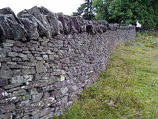
Drystone wall on Hatterrall Ridge


Shiel on Hay Bluf


Peter on Hay Bluf

Day 5 Llanthony to Hay on Wye

We left the Half Moon at 9:15am, and made our way back up onto the Hatterrall ridge. There was low cloud, so it was nice and cool, and we didn't overheat on the climb. We stopped at regular intervals to take in the marvellous atmospheric view back down to the priory, the view gradually improving as we ascended. We reached the ridge in low cloud, and visibility was limited so we used the gps to sort out which path to take when a choice of two became available.

We had a great walk along the ridge and the weather gradually improved as the day wore on. There were quite a few day walkers out again. We left the Offa's Dyke path to take in Hay Bluff and the views were really worth the extra effort. We met up again with the South African walker, Peter, who we had chatted to over dinner at the Half Moon the previous evening. He just arrived as we were leaving.

There were lots of people climbing Hay Bluff from the car park and the paths are pretty badly eroded. There were even a few people making multiple ascents and then paragliding down.

We didn't pay enough attention when we joined the road, and missed our turn off but we were able to regain it by walking around the edge of Tack Wood. Then followed a pleasant, at times steep, descent into Hay on Wye through woodland and fields. On the way to our B&B, 'Rest for the Tired', we passed a laundrette which we will visit tomorrow as we are taking the day off to see the sights.

We popped down to the Wye in the evening and the view from the bridge was pure enchantment. A fast flowing river, with swans and cygnets on a small island in the middle and two men flyfishing in the distance. A perfect image of rural England but for the fact that we are in Wales!

Sunday, August 15, 2010

Day 4. Llangattock to Llanthony

A very enjoyable day's walk starting and finishing in farm land. However, the central section was a magnificent walk along the Hatterrall Ridge. Plenty of heather and views for miles in all directions. Even Tony Drake would have liked today's section! Worthy of the Cambrian Way.

The weather remained fine until just before the descent into Llanthony. The descent
was very muddy and heavily eroded. More than 30 people passed us doing a circular walk which included the Abbey.

Shiel keeps asking me if we are enjoying ourselves yet?

Day 3. Monmouth to Llangattock.

The handicapper struck this moning! Mass was transferred from Shiel's pack to mine. It's getting to feel like I'm carrying a camping pack. However, as a result our progress improved significantly and we reached Llangattock by 4 pm. Had we not booked in at the priory I think we could have reached Pandy.

The day was mainly sunny or overcast, ideal walkig weather and our path was through typically English and Welsh farmland. A very pleasant day with extensive views to the hills. A nice change from the forest walking of the previous days.

We didn't stop at White Castle, which I now regret, as it seemed a large castle with mostly intact outer walls. However, it is not clearly visible from the path, especially on the eastern side.

There was a short sharp shower just after we left White Castle but we were fortunate to be able to shelter under a big oak tree, one of the few large trees providing cover in the area.

We arrived a little early for our b&b at Llangattock so we popped into the old church, St. Cadoc's. A beautiful old building where murals have recently been discovered under layers of plaster on the old walls. One painting of St. George, may possibly date from the 13th centuary.

There is a short but very steep climb, just before the Priory B&B in Llangattock, which the owner wisely forgot to mention when giving me loacation advice over the phone. It does however result in a marvellous view over the local farmland from your bedroom window.

We ate in the Hunter's Moon, a 13th centuary pub, only about 100m from our B&B. Although not shown on our Offa's Dyke accommodation list, the Hunter's Moon does provide accommodation.

Thursday, August 12, 2010

Day 2. Brockweir to Monmouth.

As our B&B was next to the high route to Bigsweir, via St. Briavels Common, we elected to take that route rather than the lower route beside the Wye. We didn't have any problems with finding the route so I assume the track marking has improved since the guidebook was written.

On the way to Lower Redbrook, where we had lunch in the pub below the 67 steps, we met a chap from Glossop. He was walking the Dyke N-S with his son and a friend of his son, collecting funds for the Cystic Fibrosis Society. We saw them on their last day. In a year or two we may see them in a JOGLE attempt. Finding the spare time will probably be their biggest problem. One of the advantages of being retired.

Most of today seems to have been spent walking in tunnels formed by trees and this made the views beyond Monmouth, from Kymin, appear even more impressive. It was the best view of the walk so far. I even could see some of the peaks I climbed on the first half of my Cambrian Way walk.

The Kymin

13th Cent. Gatehouse on Monnow Bridge, Monmouth

Wednesday, August 11, 2010

Day 1. Tue 10 Aug, Chepstow to Brockweir.

A good day today! Not a drop of rain and sunny most of the day with little cloud. Hardly any walking in suburbs, mostly farmland and forest. Great view of Tintern Abbey from Devil's Pulpit but be warned it is a very popular spot.

We decided to walk down into Brockweir and came across the HAPPA horse rescue centre. As any friend of Flame (ex. HVRDA) is a friend of ours, we decided to spport the centre by having our lunch there. We then walked along the West bank of the Wye to Tintern Abbey. The outgoing journey seemed a long way in the sunshine but the return by the forested East bank path passed much more quickly.

We had a little difficulty finding our B&B at Castle-a-Buff Farm, but got a very friendly welcome when we eventually found it.

We walked down the hill to the pub in Brockweir for our evening meal. Although it is obviously a 'local pub' everyone seemed happy to welcome strangers into their midst. We had a good meal at the pub and had no trouble maklng our way back up hill to our B&B.

More Photos

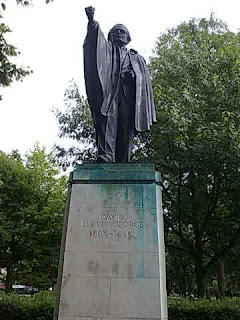
Statue in Cardiff


This years walk

Tuesday, August 10, 2010

Photos

Gareth Edwards. (one of the things you missed Tony by not getting to Cardiff!)


Dyke Path. Note the Severn Bridge in the background. Well it is on a clear day


Dyke Path or Berlin Wall?


Cardiff Arms Park


Millenium Centre, Cardiff

Offa's Dyke Walk. Day 0, Tue 10 Aug.

We left Cardiff at 9:40am and took the bus to Chepstow. The journey was about 60 minutes during which time the weather changed from very slight showers to heavy rain. We had a sandwich in Chepstow and then headed East, across the Bridge near Tescos, to pick up the path south to the Coast along Offa's Dyke. The rain was persistent and it was quite wet underfoot. It may have been the poor weather but I can't say I am impressed with the first part of the walk from Sedbury Cliffs to Chepstow. For a significant part of the way it feels as though one is walking alongside the Berlin wall with fencing on one and sometimes on both sides of the path.

It was also very poor weather for Shiel's first experience of walking a National Trail. Let's hope the weather will pick up as we go along. We returned to Chepstow via the northern most bridge, which we will cross again tomorrow to get back on the Offa's Dyke path. We are having a short day tomorrow only heading for Brockweir, which if we reach in time, we may make a side trip to Tintern Abbey.

Sunday / Monday, 8/9 August.

Shiel and I left Torquay around 9:40am by National Express arriving in Bristol around midday where we had lunch. We then travelled on, for a couple of hours, to Cardiff. The hotel was only a short walk from the bus station so we checked in, had a short rest and then went out for an evening meal at a Spanish restaurant.

Monday morning we spent looking around Cardiff Castle. Well worth a visit if you happen to be passing through Cardiff. The afternoon was spent last minute shopping and then looking around the buildings to the North East of the city, Law Courts, Museum etc. The weather was not good with showers on and off all day. We also made a special trip to Cardiff Arms Park but
sadly their shop was not open. Sorry Tony! (Shiel however was able to send you a postcard from the Millenium Stadium.) I've also got a couple of photos for the blog which may interest our rugby oriented friends in NZ).

Saturday, July 31, 2010

Recent photos

Looking North along Aberystwyth promenade

Looking South along Aberystwyth Promenade

Domen Milwyn

Duke of Edinburgh Group


Thursday, July 29, 2010

Wed 28 July

Bothy to Devil's Bridge

After going to bed early (around 8:00 pm) I was awakened by a loud banging about 9pm. It was a friendly farmer, Ian, delivering wood to the bothy, so I got up, dressed and gave him a hand to unload it. When we had finished I made a cup of tea and we had an interesting chat.

I left the bothy at about 9am, shortly after the group from Burton. It was ideal walking weather with clear views but no direct sunlight. It was marvellous to be able to see a route miles ahead rather than a few metres ahead like it had been on the walk up to Garn Gron. Being able to choose the terrain over which one is walking can make the going much easier.

The weather held all the way to Domen Milwyn, but it was a bit windy by the cairn. The weather closed in on the way down to Cwmystwyth, and it got much worse heading for the forest. It was very boggy underfoot, reminiscient of Brown Rigg Head, for those who know it.

I am now camped at the Devil's Bridge campsite. Tomorrow I intend taking the narrow guage steam railway down to Aberystwyth. I will then head for Torquay, to meet up with Shiel who arrives from NZ today. I've just walked about half of the Cambrian Way and may come over and do the second half next year, hopefully in better weather.

Wednesday, July 28, 2010

Tue 27 July

Pontrhydfendigaid to Claerddu Bothy.

An easy day today. I stayed at Red Lion, a hotel which is in the process of renovation. I left at about 9:30 am in very very light rain. The weather improved as day wore on, but there was very little sun so no suntan lotion or sun hat needed.

A new path has been put in on the left, just before Tyncwm Farm , removing the need to go through the farm. A new bridge has been put in to make it possible to cross the river higher up the valley.

I had a pleasant time walking up to Teifi Pools, but it was still a bit wet underfoot. I may have seen two red kites.

Got to Bothy about 2:00 pm and just spent time relaxing and enjoying a short day. After about an hour a group of 4 teenagers turned up and camped outside. They are doing their Duke of Edinburgh awards. I had a good time chatting to them.


Mon 26 July

Ty'n-y-cornel to Pontrhydfendigaid

I left the YHA in slight drizzle, which got worse as the day progressed. I had kindly been advised to walk on the ridge and keep the forest, a few 100m away, on my left. I saw the forest once for a few minutes and that was it!

Visibility was dreadfull, making it difficult to avoid rough boggy ground, or find the path. It was all compass and gps work. Being alone, unable to see any distant land features, it was reassuring to at least know where I'd got to on the map. I was relieved to find the road near Nantymaen. Sadly the phone box had been badly vandalised and was unuseable.

I then rejoined the battle and set off to find Garn Gron. I had to get within about 30 m of the summit before I could see any cairn or the trig point. So much for the extensive views. It was only around 3:30 when I was nearly down off the moor, near the road, that it started to clear.

It was a very pleasant evening but a very hard day. I had made a really good job of drying and polishing my Scarpas before I left the YHA, but they are saturated again. I can remember one similar bad rainy day on the Pennine Way when it took me 10 hours to get from Edale to Crowden . Todays walk was only about 8 hours but there was no steep climbing involved just very rough terrain.

Monday, July 26, 2010

Garn Gron


Grotty visibility on Garn Gron!--

Sun 25 July

Rhandirmwyn to Ty'n-y-cornel YHA

It rained overnight, but by the time I left at 9am the tent was almost dry. Breakfast was chocolate and a muesli bar. A lovely walk up the Doethie Valley gradually climbing into better weather. A very clear track, compared to yesterday, but sometimes a little boggy. As I had been unable to get any sense from the YHA, after numerous phone calls, or visiting the web site (today) I didn't know what to expect. It turns out they had plenty of room in a great location. The hostel is privately owned now and I arrived just as a meeting of the trustees was coming to an end. I had a very pleasant evening in the company of Nigel, who is currently duty warden.

If you are walking the Cambrian Way, or would simply like an overnight walk from the C&CC site at Rhand.. this is a geat spot to choose. A good way to introduce your family to the pleasures of walking and hosteling.

Sat 24 July

Talsarn to Rhandirmwyn

Nice quiet campsite for only 5 pounds, but no evening meal available at pub (Red Kite). Showers at site under renovation. I left the campsite just after 8am and headed by road to Sarnau, and thento Myddfai, where I picked up Tony Drake's route. I got lost trying to find way into wood above Llandovery, where I arrived a little after 12. I did some shopping then headed off on my own route to Rhand, via the river Towy. I thought it would be easier!

I found some 'rights of way' blocked by head high nettles and blackberry. I was wearing shorts and got very badly scratched and nettled. I washed arms and legs in the river but forgot about my face, not being able to see it. There was sufficienr blood running down the right side of my face that it caused a women to cry out in shock when she saw it near the campsite! I didn't see it until I was having a shower at the ccc site. If I had seen it earlier I would have blogged it. It looked much worse than it was. The worst problem was the pain and irritation from the nettle stings. I had a good ostrich steak in the pub but it is up quite a hill from the ccc site.

Saturday, July 24, 2010

Fri 23 July

Glyntawe to Talsarn

Had breakfast at the Cave Cafe, but it was not ready before about 9:30 rather than the 9:00 quoted.

It was a hard but very pleasant climb beside the river up the east side of Fan Hir. I was a bit worried what the climb up on to the ridge would be like just near Llyn Fan Fawr, but it turned out not to be too bad. There was then another hard pull up to the top of Fan Brycheiniog. I shared walking experiences on a little of the route, with a couple out walking for the day. They offered to take photos of me so I have proof I reached the top!

The walk down to Llyn y Fan Fach gave me one of the best all round views I've ever experienced in the British Jsles, simply magic.

The couple mentioned a farm selling puppies and they suggested I should query if they were doing teas today. They weren't but they said they would! I got a pot of tea and carrot cake in a beautifully peaceful farm garden. I had a most interesting chat with the couple running the farm and cafe.

The cafe is called, not surprisingly, The Farmyard Cafe. Kathrin Hofer, ran the cafe and said they sometimes allow campers to stay overnight. There are toilet facilities but no showers. She also mentioned the possibility of an evening meal being available. As the pub (Red Kite) at Talsarn closes now at 5:00 pm this could be a useful resting place for a Cambrian way walker. Contact details:- kathrin.hofer@ymail.com


I am currently at the campsite at Talsarn, good showers [50p] but no food available locally after 5pm.


Thursday, July 22, 2010

Just a note of caution regarding compasses

Because of dip angle effects I bought a new compass in the UK rather than trying to use my NZ compass. Last night when pitching camp I wanted a clear line of sight to the morning sun to dry the tent. I took out my compass. According to my compass East was in the wrong place, just about where the sun was setting! Low cloud hid the exact location. MY COMPASS IS NOW MAGNETISED 180 DEGREES OUT OF ITS ORIGINAL ALIGNMENT! I remember things didn't seem right getting off Fan Gyhirych and I resorted to checking wih gps. Because of the remagnetisation the weight compensation, to balance the dip effect, is also now in the wrong direction. The compass now sticks! I kept my cell phone and compass in the same jacket pocket for a while and l think that is when the remagnetisation must have taken place.

I have now narrowed down the compass problem to the case I bought for the cell phone. It is held shut by a powerful magnet! Beware Paul as I think you have the same sort of cell phone case!

Thu 22 July

I dad a rest day today. I went looking around the Dan-yr-Ogof Caves. One of the longest cave systems I've walked in. The weather was mostly dry and sunny, but for a short period of rain about 4:00 pm. Tomorrow l head over Fan Hir and Fan Brycheiniog. I will camp or stay at the YHA depending on availability.

A summit

Chartist's Cave

Cliffs above Llangattock


Wednesday, July 21, 2010

Wed 21 July

YHA near Storey Arms to Glyntawe.

Good breakfast at YHA at 7:30am, after a very good meal the previous evening. I didn't manage to set off walking until 9:30 am. I had a very scenic but hard climb on to the moor with pretty uneventful navigation to the road. However, I didn't see any standing stones, but met the road just where the track took off almost direct to Fan Gyrich. It looked a bit vertiginous but there was a barbed wire fence between me and the drop, and close up it looked less hairy than at a distance. I was overtaken continuously by army personnel out training,

Yesterday they were camped at the top of Pen-y-Fan, today I met them at the top of Fan Gyrich. The weather was much nicer today though! I got slightly lost making my way to the campsite at Glyntawe. A really well laid out site with a good pub nearby, The Gwyn Ams. I've just had a very good sirloin steak which should boost my Hb level.

I am taking a days rest at Glyntawe tomorrow to recharge my batteries, and to visit the caves nearby.

Tue 20 July

Wild camp to YHA @ Llwyn-y-Celyn.
Got up after 7:00am and the rain was easing after pretty heavy rainfall overnight. I had the muesli I bought in the camp shop for breakfast, but it was not very nice. Everything was damp but I managed to strike camp in only low cloud rather than heavy rain. Visibility was about 100m.

I set off aross the moor using gps way-points, and by and large I was able to find a path going in my direction, l eventually met up with road but didn't see the huge army lorries parked there until I was within about 30m of them! In view of the poor visibility I climbed Pen-y-Fan via the more gradual old roman road.

I was passed by soldiers going up Pen-y-Fan, and made the mistake of following them for a while. Unfortunately they had veered from my route. It was hard work getting back on track. The weather was atrocious. Two-thirds of the way up I met a group of Duke of Ed. students who had decided to call it a day. I carried on and eventually reached the Storey Arms. There is a refreshment van their! Reputedly open every day but Christmas Day.

Just then the heavens opened! I decided to make for the YHA which turned out to be an excellent decision. I met a couple called Nick and Louise Carter and she recognised me by the fact that my accent was similar to that of Mike McGowan, who they knew and who I was at school with 50 years ago. A very happy ending to a pretty miserable day

Sunday, July 18, 2010

Sun 18 July

I spent the day in Crickhowell recovering. I had the largest breakfast I have ever had, for £5, and then went back to the tent to sleep it off. I am now in the information centre using the Internet. It's nearly 5 pm and I'm just starting to feel as though I can set off again tomorrow. There will probably be no posts for a while as I am thinking of taking 2 days to get to Glyntawe, via the Storey Arms, with 2 wild camps on the way.

I am now returning to the campsite to clear my backlog of washing.

Photos


Saturday, July 17, 2010

Sat 17 July

Did I suggest yesterday was hard? Forget that. Yesterday was easy. Today was hard! (For my scientific friends that is what we call a re-calibration.)
I had a great evening meal at the Grange in Capel-Y-Ffin amongst very good company, not walkers this time but horse riders. The conversations would have been completely unintelligible to me but for my almost daily visits to Hutt Valley RDA.

I got a breakfast for 8:00am but was delayed polishing my boots etc. It was well after 9:00 by the time I left the Grange. By the time I had rung Shiel (my wife) from the phone box opposite the Capel, (of -y-Ffin fame) it was about 10:00 am.

Instead of taking Tony Drake's route up the valley I took a very steep, but clear path straight onto the end of the ridge fron where it was a gradually sloping walk to Twmpa. The way underfoot was reminiscent of walking the Pennine Way above Edale.

At the top I had a chance neeting with two blokes, Brian and Ian, out on a day walk from Merthyr. Photographs may hopefully soon appear. We had a great time chatting while we walked along, putting the world to rights, and it made the climb to Waun Fach much easier for me. They left me on the walk to head down to the Grwyne Fawr reservoir. I thought I had done most of the climbing by then so I was in for a few surprises. The days had started with terrible wind and rain but gradually got better as the day wore on, but the cross wind was always pretty fierce.

To give credit to Tony Drake, today's walk must be one of the best ridge walks in Britain. If you are only carrying a day pack. However with a full camping pack, and I'm not a light packer, it was very hard work. I reached the campsite after 9 hours, absolutely knackered! Mind you it is possible some of the fatigue and sweating I have suffered since the walk might have other causes. However the 'mother node' in my neck was smaller than it's been for 20 years, after the walk.

The campsite in Crickhowell is an excellent walkers campsite but you have to be over 18 years old.

Fri 16 July

It was about 9:15am by the time I left the B&B. By the time I had bought a compass suitable for the northern hemisphere it was about 9:45am, and by the time I eventually found the correct road leading to sugar loaf it was nearer 10:00!

The navigation to the top of Sugar Loaf was uncomplicated but the steep track, especially near the summit, was hard work. I only spent a few minutes at the top as it was clear rain was heading in. There were a few people up there and one group offered to take a photo of me by the trig. point. I checked my way off Sugar Loaf with someone on the summit and then made an uneventful trip down to Forest Coal Pit. I made a phone call to my B&B to tell them I was running late.

I stopped at a farm, on the way up to Garn-wen, to take on extra water and had a very enjoyable conversation with a farmer and his wife. I positively sailed up the next few km. It made me realise that meeting interesting friendly people is more important to me than extensive views from a mountain ridge.

After leaving the farmhouse the route was well defined and almost became a 'motorway' when it joined the Brecon Way. I met a large group of school children doing their Duke of Edinbrough walk, near where the Brecon way turned down East. The weather deteriorated to periods of howling wind and rain interspersed with bits of sunshine. I met a chap who said I would have to walk down over the moor to Capel-y-Ffin but I eventually found a pretty clear path down, starting at a large cairn.

When tired at the end of the day going steeply down hill is nearly as bad as going up

Friday, July 16, 2010

Thu 15 July, Pontypool to Abergavenny

I left Ty Scon Jacob at 9:30am and found a quiet path down to town, via a reputed Old Roman Road and a short path through the forest. I the went up a very quiet country lane to meet up with Tony Drake's route a few hundred yards past the folly. A bit tricky finding the route across a river, behind a farm but after that it was simple contour walking just to the east of the ridge. I had extensive views, and it was quite windy, but at least the morning rain had cleared. I lost the track about a mile or two from the road and it was very hard going underfoot until I picked it up again. I stopped to rest at the road crossing and met up with 4 men out walking for the day. After moving off, one of them, a fellow Yorkhireman, came back to tell me that I should turn off the road onto the path at a small horse trough. That was very useful information and I had a long, if uneventful climb, up to Blorenge. The first part of the descent to Abergavenny was well marked. Then I followed a long tricky descent through high bracken before I eventually found the path which leads down to a tunnel under the canal. Walking down Blorenge was harder than walking up!

Thursday, July 15, 2010

Wed 14 July, Lower Machen to Pontypool

I stayed at The Forge B&B in Lower Machen, which I reached via Draethen. There was a very nice pub in Draethen, good atmosphere, and a pint of Guinness with a cajun chicken with salad and boiled potatoes cost less than 10 pounds!

The landlady at The Forge suggested two ways to get up Mynydd Machen. I took the JOGLE version, a nice quiet coutry road up to join the Sirhowy Valley Walkway, which took me all the way to the top of Mynydd Machen, in fine weather. The path down through the forest at Risca appears to have been blocked by bulldozed trees, whether by accident or design, I am not sure. Local ramblers might be interested in the changes. I had a pleasant walk through the sports ground in Risca where I met two blokes, my age, who I asked about restaurants. They suggested a little cafe on the canal, just metres off the road up to Twmbarlwm.

It started to rain whilst I was in the cafe and continued intermmitantly until I reached the parking area just before the last steep pull for the summit. The path along the ridge was clearly defined until about 700m from the Blaen Bran reservoir where I lost the path in the long bracken. I eventually found a path to the reservoir and then headed to my B&B at Ty Shon Jacob farm via Upper and Lower race. The farm is about 300m above the town of Pontypool so I didn't bother making an extra trip down to a pub for a meal. It rained heavily, on and off, all night

Tuesday, July 13, 2010

Cardiff Photos

Tuesday July 13, 2010

I caught a bus to Cardiff Castle fom just outside my hotel, The Tane, arriving at 8:30am on a dull and overcast morning. Good walking conditions initially. I walked up the east bank of the Taff river. Just before the turnoff to the canal I met up with the snail I met last year on my JOGLE. He's obviously making better progress than I expected!

Shortly afterwards I met up Glyn Brewer, and he acted as my guide to just before Tongwynlais. He used the Taff trail, which appeared much simpler than the canal route in the book. It was an interesting encounter and Glyn was very knowledgeable about the history of the region. The time flew by.

I soon arrived at Castell Coch and then climbed on to the Rhymney Valley Ridgeway. I followed the standard route to about 1 mile past Rudry when l diverted, via Draethen, to my B&B, The Forge, at Lower Machen. l went back to the pub in Draethen for my evening meal. A Guinness and cajun chicken with salad for just under 10 pounds. The rain was not too unpleasant until just after Rudry and it had cleared up again in time for my trip to the pub.


The Snail making steady progress

Monday, July 12, 2010

The beginning

Well after a long period of dry weather the rain has started, just as I set out for Cardiff by train. I will soon be on my walk.

Tuesday, July 6, 2010

Mr. Bean Goes Walking in Wales.

The title above is in deference to my former colleagues on the RV Tangaroa but it is already becoming too prophetic for comfort. I am planning a walk on part of the Cambrian Way. In the process I was trying to find accommodation at a campsite near Talsarn. I made contact with a very pleasant lady at the campsite and pointed out the uncertainty in my arrival date due to walking a long way on foot. She said there would be no need for me to book as a single person tent could be easily accommodated in an emergency. I then went on to inquire as to where I could get an evening meal. She suggested the pub in Talsarnau. I took this to be some kind of local name for Talsarn. However my suspicions were aroused when in a later e-mail she suggested that failing the pub being open I could always order an Indian take away from Harlech.

Now my knowledge of Welsh geography is slim at best but I knew that in planning my route I had never come across the name Harlech. On checking I found it is more than 100km from Talsarn! However, not surprisingly, Harlech is very near Talsarnau, which also has a campsite.

I think for me (or even Mr Bean) this is a record. This year I've managed to get lost before the walk has even started.

Friday, March 26, 2010

Charities have now received their funds!

Hi All,

well it's been a long time coming but at last I can report that Charity Giving has paid out both the Malghan Institute in New Zealand and Leukaemia Research in the UK. The Malaghan Institute received $NZ 2597.11 on 3/2/2010 and yesterday (26/3/2010) Leukaemia Research received ₤1170.38. There were also contributions totaling $150 direct to the Malaghan Institute from Rob Crozier and Mike Rietveld in New Zealand.


Between us we’ve raised over $NZ 5,000 dollars or ₤2500. Thank you one and all for your support.


The long distance walking season appears to have already opened up in the UK and Mick and Gayle, who provided me with support in Wolverhampton last year, are 5 days into their walk from Dover to Cape Wrath. You can find their site under Mick&Gayle in the links on the RHS of this page. They are collecting for Help for Heros and would appreciate your support. They provide daily updates of their adventures which should keep you entertained for about the next 2 months.