Well we are now back in New Zealand in a spring-time that seems more like mid-winter. The woodburner and the heat pump are running and I'm still feeling the cold.
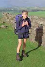
I've got Colin to post the photo Sally took of me at Land's End. It's quite helpful she took the picture as I forgot to sign the official book at Land's End to say I had finished the walk. Doh! It is a bit sad really as if someone checks the books for statistical purposes it will look as though I started out from John o'Groats but never reached Land's End. There was an official photo taken of me at Land's End but I have yet to see it and with the UK postal system in its current state it may be a while before I do.
Health Issues
By the end of the walk my sore right toe was all but healed and generally I was feeling pretty fit. When I compare the photographs of myself taken just before the walk with those taken just after I clearly look a lot healthier after the walk. My weight dropped from 71.6kg (11st 3lb) measured in Torquay before the walk to 64.6kg (10st 2lb) measured in Penzance after I finished. However after less than 2 weeks holidaying in the UK my weight was back up again to 69.1kg (10st 12lb). My home scales now put me at 69.7kg. I have had no leg or foot problems since the walk ended. The GERD, which I was suffering from before the walk, has disappeared. I stopped needing Gaviscon after about a fortnight of walking and I've not taken Losec now for 3 weeks. I did however have my first ever full blown migraine the evening of the day after the walk finished and I've been troubled with headaches on and off since, but thankfully not with the same intensity.
I had a blood test last Thursday and my lymphocyte count was in the normal range at 3.5x10^9/L and fractionally below what it was when the walk started (3.6x10^9/L). My red cell count was just in the normal range when I started the walk but slightly below the normal range when measured last week. It has been lower in the past. My haemoglobin, at 130g/L, is the lowest it has ever been, having dropped from around 140g/L before the walk. I am hoping this is just a result of the foot impact over 1000 miles of walking and not a CLL related change. It will be interesting to see if it returns to its normal level over the next few weeks/months.
Donations Closed
I went to the Charitygiving website today and locked out any further donations for Cancerwalker. However anyone who wishes to do so can still go to the links provided on this page and donate directly to either the Malaghan Institute or Leukaemia Research should they wish to do so. When I hear back from Charitygiving I will let you know the final amount we raised for the Malaghan Institute and Leukaemia Research plus any monies donated directly to the charities as a result of the walk.
Acknowledgments
Thank you all for your generosity! Many thanks also to those of you who took the time off to come and walk with me. It made my journey much more enjoyable and memorable. Thanks also to those who provided transport or accommodation or provided a laundry service and those who did 'all of the above'. I truly enjoyed your company. Thanks to those of you who came to take me out to dinner and help me relax after a long day walking. Your companionship was much appreciated. Some were old friends, some I hadn't met for almost half a century, whilst others were new friends met through the walk. Thank you one and all.
Finally I must thank those of you working behind the scenes. Many thanks Ron for you support with publicity in the UK and on the ACOR site. Thank you Colin for keeping the blog updates flowing and dealing with communications queries. Thank you Sarah for converting my text messages about donations into actual donations on the Charitygiving website. It just a pity we weren't able to maxout your credit card with the donations! Thanks to Weed for acting as a phone messenger and joining Sally, Kit, Robin to come and cheer me in at Land's End.
Finally thanks to my wife Shiel for taking down my dictated blog entries in New Zealand, typing them up and then e-mailing them for Colin to post. This was needed for the first half of the walk to Newcastle. In Newcastle I got a new phone and was able to blog directly to Colin. Shiel also provided me with transport at the start and end of each day for the last 8 days of the walk in Devon and Cornwall. This meant I could travel a more direct route to Land's End without worrying about finding a campsite at the end of the day. It also meant I had the luxury of B&B accommodation.
Gear
The biggest success in the equipment area has to be my map system. I used double sided A4 sized maps on a scale of 1:50,000 downloaded from a DVD supplied by Quo. I used their maps as quite simply, at only 100 UK pounds, they were much cheaper than everyone elses. I'm still waiting to get a refund for the VAT I paid though. If they read this they might like to note I would be happy for them to pay it directly to the charities I am supporting. On most days I printed the maps to the largest size I could that still allowed me to get the whole day's walk on one double sided page. In city areas like Edinburgh and Wolverhampton however I finished up needing two maps per days walk to be able to resolve all the street detail. This however may just be a problem for older walkers, like myself, who suffer presbyopia. I laminated all the maps and never had any trouble with them on even the wettest days. In fact they made useful waterproof mats when one wanted to sit on a wet park bench. I stored the 'map in use' rolled up under a loop on one of my rucksack straps. However I think they would also roll up quite nicely around a walking pole where they could be held in place by a couple of Terry clips. The laminated maps were quite heavy so I only carried enough for about 22 days at a time. My sister posted the maps, as needed, to the nearest campsite at which I intended to stay. It appears the 'Post Restante' service is no longer available in the UK, or at least that's what I was told. I only lost one of my maps, somewhere near Pitlochry.
When I started the walk I had two pairs of old Scarpa leather boots. I estimate one pair had done about 500 miles, the other 1200miles. I started in the 500 mile pair and used them until I was joined by Shiel who brought with her the older pair. I used them for the last part of the trip. The first pair are badly worn down at the heels but when repaired are probably good for a few hundred miles more. The older pair, which were repaired just before the walk, will probably soon start to leak where the leather flexes most in the region just behind the smallest toe. They are already badly cracked. The older Scarpa boots are fantastic at keeping the feet dry. Water only gets in if it goes in over the top of the boot. I'd like to get another new pair of the boots I used but sadly they've changed the design and I don't like the new ones.
I was a bit dissapointed with the Osprey Aether 85 rucksac. I think some of the problems arose from the fact that I had to buy it via the Internet and I think I may have got a harness one size larger than I should have. I could get the harness to fit very snugly by pulling on the tension straps but I think some of the pulling may have been needed to compensate for the possibly oversized frame. This may explain why the metal frame rods punched through the harness. Two of the lid buckles also broke. I think some of the packs' weakness results from the designers reducing the amount of material used in the buckles etc to keep the weight down.
Tuesday, October 6, 2009

Wednesday, September 9, 2009
Day 65, Botallack to Land's End (Planned: Balnoon to Land's End), Wed 9 Sep
Summary
Today's Distance: ~25.8 km (16 miles)
Total Distance: 1628 km (1012 miles)
Distance to go: 0 km (o miles)
Report
Shiel put me down on the road outside Botallack at 8:40am and the final day of my walk had begun. What a contrast to yesterday. I could see where l was heading! Extensive views in every direction. Yesterday's walk would have been much more interesting in sunny weather.
I took the B3306 into St. Just, l missed the more direct route yesterday. However had l found it l wouldn't have met up with Shiel.
I took a small road out of St. Just, heading for the YHA in the Cot Valley and then a path up to the SWCP. Looking at the map now I see that the route I took was not exactly the one l'd planned. It's good to see that some things don't change.
I had a very pleasant and sunny walk along the SWCP to Sennen Cove where I am writing up the first part of this report. I'm in no hurry for once. It's only 12:15 and l've only 1.5 miles to go to Land's End.
I've just heard from my sister Kathleen that they are all waiting for me at Land's End so l can finish the walk...
I finished the walk at about 2:45pm and had an expected reception from Shiel, my sister Kathleen and brother-in-law Robin. An added boost however was that Kit and Sally were also there to greet me! They had driven down from Devon, about 150 miles, just to cheer me in. They even brought a donation with them from their friend Martin who they had told about my walk. Regular readers will remember that Kit and Sally came to take me out for an evening meal when l was in Devon. Kit was treated for PLL, a very rare form of leukaemia.
It is the generosity and friendship of such people, and others like them, who only two weeks ago were complete strangers, that will be my lasting memory of this walk. You hear and see so much gloom and doom in the press that you get a jaded outlook on humanity. To improve your outlook on life:-
1. Sell the TV
2. Stop reading the papers.
3. Undertake a walk for a charity.
You'll also be able to 'come off' the Prozac.
I will sum up in a few days time and also add some comments on kit and maps which hopefully will be of help to others. I will continue accepting donations until we return to New Zealand in early October.
Photos -- check out page 5 and 6 of photo album for a few more photos
Day 64, Gwithian to Botallack (Planned: St. Agnes to Balnoon), Tue 8 Sep
Summary

A little further down the road I met up with Chloe and Simone, two sisters down from London, who were out for a walk. They acted as my guides to near Nancledra and suggested my original route, via Amalveor, would be the easiest to follow on the ground. Walking with them was really enjoyable and boosted my morale for the day.
The boost was to be short lived however as l arrived at Amalveor to find the path obstructed with path closed signs. I rang the number on the sign to get detailed information but no one was in the office who knew about the closure, set up in April. The girl in the office rang back but only seemed to have details of a SWCP closure. I wonder if the sign was put in the wrong place as it talked of a slip near a cliff and no cliffs are visible on my OS map of the path west from Amalveor. In the end I decided to follow a parallel path about 1km south, starting from Embla.
I got to the farm road just north of Borifty without too much of a problem and found a path, not shown on the OS map that finished up near Tredinnick. Visibility was quite poor but by good fortune someone from the farm was arriving by car and I got useful information from her. I headed on a path to Lanyon Farm but took the wrong path at a fork. This added a few 100metres to my walk but I didn't mind as Lanyon Farm do cream teas, and they had no scone shortages! Recharged, I headed NW up the road towards the turn off to Little Bosullow, where I met up with Shiel.
Although the rain was now quite heavy l decided to walk on south west towards Tregeseal. I knew I would get the wrong path among the plethora of paths near Carn Keidjack, and get the wrong path I did. I finished up just south of Carnyorth. However I could see the farm builings and decided it would be quicker to walk on a farm access road than walk on the very boggy paths across the moor.
Today's distance: ~33.8 km (21 miles)
Total distance: 1603 km (996 miles)
Distance to go: 26 km (16 miles)
Report
We had breakfast at 7:30 am and I was back on the road, just before Gwithian, at 8:40 am. The weather was overcast, tending towards rain. I reached Hayle in good time and stopped to take a photograph of the memorial to Rick Rescorla (?) who was born in Hayle and lost his life helping fellow employees in the evacuation of one of the twin towers during the 9/11 terrorist attack. I thought it might be of interest to my readers in the US, including my son Colin, who organises this blog, and now resides in Connecticut.
We had breakfast at 7:30 am and I was back on the road, just before Gwithian, at 8:40 am. The weather was overcast, tending towards rain. I reached Hayle in good time and stopped to take a photograph of the memorial to Rick Rescorla (?) who was born in Hayle and lost his life helping fellow employees in the evacuation of one of the twin towers during the 9/11 terrorist attack. I thought it might be of interest to my readers in the US, including my son Colin, who organises this blog, and now resides in Connecticut.
While taking the photograph l was spotted by a friend of Ricks who provided me with extra information about him and mentioned the fact that there is a website dedicated to his memory. He also pointed me towards a pictorial display of some of Hayle's interesting industrial history.

He also gave me dire warnings against following my proposed route across the moors. I took the road to Lelant Dons with one of my famous ''long cuts'' near Splattenridden. I stopped someone, Nick Ridge, to get local knowledge on my plannd route and he did not seem phazed by it. He also very kindly gave me a donation.
A little further down the road I met up with Chloe and Simone, two sisters down from London, who were out for a walk. They acted as my guides to near Nancledra and suggested my original route, via Amalveor, would be the easiest to follow on the ground. Walking with them was really enjoyable and boosted my morale for the day.
The boost was to be short lived however as l arrived at Amalveor to find the path obstructed with path closed signs. I rang the number on the sign to get detailed information but no one was in the office who knew about the closure, set up in April. The girl in the office rang back but only seemed to have details of a SWCP closure. I wonder if the sign was put in the wrong place as it talked of a slip near a cliff and no cliffs are visible on my OS map of the path west from Amalveor. In the end I decided to follow a parallel path about 1km south, starting from Embla.
I got to the farm road just north of Borifty without too much of a problem and found a path, not shown on the OS map that finished up near Tredinnick. Visibility was quite poor but by good fortune someone from the farm was arriving by car and I got useful information from her. I headed on a path to Lanyon Farm but took the wrong path at a fork. This added a few 100metres to my walk but I didn't mind as Lanyon Farm do cream teas, and they had no scone shortages! Recharged, I headed NW up the road towards the turn off to Little Bosullow, where I met up with Shiel.
Although the rain was now quite heavy l decided to walk on south west towards Tregeseal. I knew I would get the wrong path among the plethora of paths near Carn Keidjack, and get the wrong path I did. I finished up just south of Carnyorth. However I could see the farm builings and decided it would be quicker to walk on a farm access road than walk on the very boggy paths across the moor.
I met up with Shiel at Botallack from where I head via St.Just to Land's End tomorrow. Todays walk was long, at 9 1/4 hours but I find it easier now to continue a long day rather than get up early the next morning. The end is in sight and I've not yet told you of my observations of single industrial gloves, seen on at the side of many roads, or of my conversations with sheep and cows.
Monday, September 7, 2009
Day 63, Perranporth to Gwithian (Planned St. Coulomb Major to St. Agnes), Mon 7 Sep
Summary
Today's Distance: ~30 km (18.7 miles)
Total Distance: 1569 km (975 miles)
Distance to go: 60 km (37 miles)
Report
Breakfast at 7:30am and back on road at Perranporth sea front at 8:35am. My first day back on the South West Coast Path. l found this first section to the outskirts of St. Agnes a little vertiginous, but l'm sure most people would have no problem with it. I left the SWCP near Cross Coombe and headed via Wheal Kitty and the outskirts of St. Agnes through the Cemetary and a good path to Mingoon (?). I stopped at the shops in St. Agnes and bought a bottle of milk shake which l drank on my way to the Cemetary. I took off my pack and jumped on the bottle to sqash it and reduce its size. I then started pushing it into one of the side pockets of my pack. A lady walking by must have been watching all this action and very kindly offered to drop the bottle in a waste bin as she was heading back into town. It never ceases to surprise me how helpful passing strangers can be. Perhaps l've been reading too many newspapers.
I continued on the road through Towan Cross to Porthtowan where l wisely asked directions at a garage. I was informed that my planned route via a disused airfield was not possible as it was MOD land, so at Factory Farm l returned to the SWCP. Then followed a pleasant but at times arduous walk to Portreath. Quite a few steps to go up and down across two small valleys. On the way to Portreath l met Brian and his family out for a walk, we chatted and they very kindly gave me a donation. I stopped at the Portreath Arms for lunch where l received my second donation of the day from Martin. I went wrong when leaving Portreath and finished up heading for Illogan. I eventually found my way out on the B3301 which l followed to a turnoff at Bassets Cove where l joined the SWCP again.
I followed the SWCP to a car park just past Hell's Mouth where l met a Dutchman, another long distance walker, and we chatted for a while about walking. I then followed the B3301, with some care to Gwithian from where l leave for Hayle (and beyond) tomorrow. We had our evening meal in a pub at Phillack where l had the best salad yet supplied as a side dish to lasagne.
Sunday, September 6, 2009
Day 62, Rosenannon to Perranporth (Planned: St. Mabyn to St. Coulomb Major), Sun 6 Sep
Summary
Today's Distance: ~23 km (14.4 miles)
Total Distance: 1539 km (956 miles)
Distance to go: 90 km (56 miles)
Report
Breakfast again at 7:30am and I was placed on the road at Rosenanon at 8:55am. I decided to ignore a footpath shortcut and followed the road via Borlasevath, Tremayne and Tregamere to St Coulomb Major. My experience with short sections of paths later today, suggests l made the correct decision.
l was in St. Coulomb Major by 10:10am and rehydrated with a bottle of chocolate milkshake: 500ml of water, sugar and fat all for less than a pound! The weather improved as l walked on through White Cross and l reached St. Newlyn East by 1:30pm where l had lunch. At Fiddlers Green my troubles began. l wanted to take a path to Scotland Farm and l couldn't find it. The path was shown on my map emerging from the back of a house so l went to the house and knocked on the door. A very pleasant chap came out and said he would take me to where the path started. It was good that he did as l wouldn't have found it without his help. (Sorry l should have taken a photo.) Once l had climbed up onto the path corridor it was easy to follow; fenced on boths sides and just over a metre wide. The going wasn't too bad as some of the vegetation had recently been trimmed by the gentleman to whom l had been talking. Nearer to Scotland farm the track was harder to find and very, very boggy and l could only maintain dry feet by stepping from one clump of bog grass to another.
The next section of path was even more of a problem, but this time largely man-made rather than natural. It was only about 300m in length and joined two farm access roads which are also public footpaths over some of their length. I've attached photographs of the entrance to the path and the electric fences, barbed wire and corrugated iron blocking it (photos coming later). I've also shown how the exit to the path is still quite clearly marked, unlike the entry. I continued to follow paths, which gradually improved, all the way into Perranporth. Perranporth is on the South West Coast Path (SWCP) and l walked the section from Penzance to Minehead in 2006. As a result my feet have actually walked all the way from John o'Groats to Land's End, l've yet to walk it at 'one go' though. Tonight we are staying in a B&B near Goonhavern.
Photos
Go to page 5 of the photo album for new photos
Saturday, September 5, 2009
Day 61, Watergate to Rosenannon (Planned:Wainhouse Corner to St. Mabyn), Sat 5 Sep
Summary
Today's Distance: 32 km (20 miles)
Total Distance: 1514 km (941 miles)
Distance to go: 113 km (70 miles)
Report:
We breakfasted at 7:30am and l was back on the road in Watergate at 8:55am. Rain threatened but did not eventuate and l had an enjoyable walk on quiet country roads. I walked via Tuckingmill to St. Tudy where l arrived in time for an over 60's morning coffee and biscuit. I asked directions and was advised to ask a couple of local ladies. I was told l would have to cross the border.
One of the ladies told me how she had had to cross the border when she got married. However she went on to say that after her husband retired she got him to take her back home across the border. The border in question? The parish border between St. Tudy and St. Mabyn.
From St. Tudy l crossed the border and went via Cross Hill and Castle Killibury to Wadebridge. This required an unpleasant 1km walk beside the A39. l did however meet and chat to 3 cyclists heading north on the A39 on their LEJOG. I arrived in Wadebridge about 1:35pm where l met up with Shiel and we had lunch. Like yesterday we ordered 2 cream teas and were told, like yesterday,that they had only enough scones to make one cream tea. In fact they had insufficient clotted cream to make one cream tea. Is there a national scone shortage? I left Wadebridge via Burlawn and went past the St. Breock wind farm. Near the wind farm, on the Saint's Way, l passed 4 more cyclists starting their LEJOG.
I ended my day at the village of Rosenannon, about 3miles short of St. Mabyn, the end point I originally planned for tomorrow. We are staying at a farm B&B near Winnard's Perch and we had our evening meal at a pub in St. Coulomb Major. A friend of mine in NZ, Murray S, has suggested that my JOGLE walk is just an excuse to make a 66 day, 1000 mile pub crawl. The idea is not without merit.
Friday, September 4, 2009
Day 60, Tamar Bridge to Watergate (Planned: Thurdon to Wainhouse Corner), Fri 4 Sep
Summary
Today’s distance: 29.8 km (18.5 miles)
Total distance: 1483 km (922 miles)
Distance to go: 145 km (90 miles)
Report
Last night we stayed at a farm B&B at Hopworthy. It had very friendly owners who breed quality eventers, two of which have competed at international level. (lt may interest those planning a LEJOG that the cost for each of us last night was less than my staying at the Caravan Club site in Tewkesbury and breakfasting in Witherspoons).
I started walking from the Tamar bridge at 8:45am. The weather was much like the last few days, showery with a strong cold wind, very autumnal. I only met one other backpacker today

and s/he was progressing more slowly than l was. It will probably take many generations to finish it's JOGLE. The roads were quiet and l made good time to Whitestones where l headed south and then south west to Middle Wheatley by which time l was off my map. I had to navigate to Canworthy Water using a 1 in 250,000 car map. It was a much smaller place than l expected, with no lunch place that l could find. I climbed steadily to Hallworthy where l joined the A395 and found a pub so l was able to have a late lunch. After lunch l headed south west for about 3km and then picked up a path to an old airport. From there l headed south west, past the Crowdy reservoir,
Because l have loyal supporters in the US l decided to extend my walk today and instead of ending my walk at the Crowdy reservoir l decided to walk on for a few extra miles. I wanted to end my day(s) with Watergate, like another well-known Richard. Sadly the village is too small for a sign saying 'WATERGATE.' A couple of locals told my wife they took the name plate down during the last war and it never got put back up again. However l did manage to get a photo of the name plate of the local farm.

Day 59, Petrockstow (Dolton) to Whitstone (Thurdon), Thu 3 Sep
Summary
Today’s distance: 23.4 km (14.5 miles)
Total distance: 1420 km (882 miles)
Distance to go: 208 km (129 miles)
Report
We had breakfast at the B&B in Merton at 7:30 am and Shiel deposited me at the cross roads at North Town by 8:30. I headed west along what was at first a busy road but after 9:00am there was an appreciable drop in traffic. I took a path through a wood near Filleigh Moor, to cut off a corner, and continued to Shebbear where l found a small local store open. I was able to buy two orange drinks.
Just before Shebbear l had met two heavliy laden cyclists and had asked where they were headed. They were heading for John o'Groats via Wales and lreland, before taking a ferry to Scotland. We compared notes before heading our separate ways.
From Shebbear l continued west, first via a very boggy path and then via a quiet minor road to Oxenpark, where l then headed south west towards Woodacott and then Holsworthy. I arrived at the A388, 1km north of Holsworthy, just after 1:00pm and found Shiel waiting. We arranged to meet up again near the church and then go to lunch. On closer inspection however l found there were two churches so by the time we eventually met up in the centre of Holsworthy it was 1:50pm. We went to a small cafe for a cream tea each but had to make do with one between us as they only had two scones left. We parted in Holsworthy at 2:55pm with the arrangement that l was to walk to the bridge over the Tamar on the small minor road about 2 miles north east of Whitstone. I made better time than l expected and was there by 4:30pm.
We both then travelled by car to our B&B in Hopworthy where l had a good soak in the bath before we headed for an evening meal at the pub in Pyworthy. To get to Wainstone Corner, the original end point for tomorrow, would only be 12km. However l intend re-routing slightly. I plan to walk to Whitstone and then head for Middle Wheatley. I then drop off the edge of my map! Following a road atlas, 1:250,000, l plan to head roughly south to South Wheatley and then south west to Canworthy Water, where l will again get back on my map, meeting my old planned route about 0.5km south of Trelash. I then plan to continue on towards St. Mabyn stopping at some convenient location l reach between 4:00 and 5:00pm.
Wednesday, September 2, 2009
Day 58, Romansleigh to Dolton (Petrockstow), Wed 2 Sep
Summary
Today’s Distance: 23.4 km (14.5 miles)
Total Distance: 1420 km (882 miles)
Distance to go: 208 km (129 miles)
Report
I had a full english breakfast at the B&B and then Shiel put me back on the road at Lightleigh Cross at 8:45am. I went on minor roads via Spittle Farm to Elstone and then on a path to Colleton Mills. It was overcast, but not raining, at first. Shortly after crossing the A377 l was offered lifts twice within the space of five minutes. Sadly l had to turn both offers down as l headed for Dolton via Hansford Cross and Ashreignry, and then Hollocombe Moor.
The rain started when l reached the crossing of the A3124 and l was soaked by the time l reached the pub in Dalton, around 1:00pm.
There l met up with my wife, Shiel, and my sister and brother-in-law who had traveled up from Torquay for the day. We had a great time chatting, but service was slow and it was after 2:00pm before we went our separate ways. The rain started to pour down as l headed for the Tarka trail and Petrockstow. I got to Petrockstow by about 4:50pm and stopped at the junction in North Town where Shiel will drop me off tomorrow.
We are staying at a nice B&B in Merton and had our evening meal at the pub in Petrockstowe, The pub had a great atmosphere and served excellent food. One of the best meals I’ve had on the whole trip.
As my stopping points are no longer constrained by campsite locations tomorrow l will be heading in the direction of Holsworthy rather than Thurdon and hope to join the planned route again at Pyworthy.
I was carrying slightly less weight today as Shiel took my dirty washing to a launderette in Great Torrington. In a single visit she managed to melt my two polypropylene vests in the dryer, something l had been unable to manage in two months of traveling.
Donation Site Issue
People from Europe and the United States have been unable to make a donation on the Charity Giving website. The website is experiencing difficulties with exchange rate and banking charges for funds incoming from outside the UK. Hopefully this issue will be resolved promptly.
In the mean time, non-UK user can send a cheque payable to “The Dove Trust” and send it to them via snail mail, and on the BACK of the cheque put "Richard Barr cll walk".
The address to send to is:
The Dove Trust,
Park Farm,
Dareham Road,
Bawdeswell,
Norfolk,
NR20 4AA,
United Kingdom.
They will gather all/any cheques and in the due course of time will process them as a single transaction (this will help keep down bank fees), but will acknowledge each individual who sends a cheque by showing the amount and the donors name on the www.charitygiving.co.uk/cllwalker web site.
If you have any questions please contact me on cllwalk@gmail.com
Day 57, Wimbleball Lake to Lightleigh Cross, Tue 1 Sep
Summary
Today's distance: 30.3 km (18.8 miles)
Total distance: 1397 km (868 miles)
Distance to go: 232 km (144 miles)
Report:
I left Wimbleball Lake at 7:45am on a path heading roughly SW. It was quite boggy. It led to a road by the River Hadden, which deteriorated into a very muddy 4wd track. There were signs saying road closed but I assumed they had been left after a previous job on the road. However I eventually met up with workmen digging up the track who wanted to send me back the way I'd come. When I explained that I was doing a charity JOGLE they very kindly halted work for a few minutes so I could eventually make my way to Bury and then by minor roads to Brushford where I was able to buy sandwiches at a garage. Then I took a cycle track to West Knowle running along an old railway bed. There seems to be a discrepancy between where the track ends and where the map says it ends. I then followed minor roads via Hawktree Moors and Roachill to the crossing with the A 361 at Side Moor where I had a snack in a transport caravan cafe. I asked for a toasted current teacake with cheese, which was not on the menu, but they quite happily made it for me. Then I had a very pleasant high walk, with extensive views, from Batsworthy Cross via Ash Moor to Gidley. I then headed NW and then W to Great Odam, Measbury and West Garland moors. All this time l was trying to make contact with my wife Shiel who had hired a car and was to take me off the road and return me to the same spot the next morning. Most of the problem was caused by the fact that I was giving her directions from a 1:50,000 map and she only had a 1:250,000 map in the car. Most of the small places I mentioned were not on her map! Eventually we meet up at Lightleigh Cross from where I will continue the walk tomorrow. We are staying in a friendly farmhouse B&B about 2 miles from the cross-roads and had a good meal at the pub in Chittlehamholt. Today was a longer walk than I would have wished, at 10 hours, but it means tomorrow's walk will be shorter.
Monday, August 31, 2009
Day 56, Flaxpool to Wimbleball Lak, Mon 31 Aug
Summary
Today's Distance: 22.6 km (14 miles)
Distance completed: 1366 km (849 miles)
Distance to go: 262 km (163 miles)
Report
It's been one of those rare days today where l haven't got lost and had to back track. I left Flaxpool about 7:30am, after chatting with a group of walkers who were walking the Macmillan Way. It was overcast all day, especially when l climbed above the 300m mark. l think l was just walking in low cloud. I made my way on very quiet minor roads all day. A good route in that respect.
I went via Tolland to Brompton Ralph where l got into conversation with two ladies, one whose day it was to work in the shop. The shop was closed but she very kindly opened up to sell me food and drink. It was the only shop l passed between Flaxpool and Wimbleball Lake, the downside of todays route.
From Brompton Ralph l followed the route to Clatworthy and along past the reservoir to eventually reach Wimbleball Lake by 1:30 pm. At 6 hours l think that is my shortest day.
There is a good little tea room beside the lake which also acts as reception for the campsite. I started with steak pastie and tea followed by a walkers cream tea.
There is a pub within about a mile and a half at Brompton Regis and l will head there for my evening meal . Breakfast looks like being nuts and chocolate as the cafe doesn't open until 11:00am.
Hopefully my wife will be getting a hire car tomorrow and so l will no longer be constrained to picking a route defined by campsites. For example the day that originally went via Thurdon may be re-routed via Holsworthy. I just make this point in case anyone is thinking of meeting up with me. I'll try and blog any revised route beforehand. However some places, like Wimbleball Lake have no cell phone coverage. A quiet day and it looks like another quiet day tomorrow.
Update:
As my left big toe rubs in my boot l decided to go to the pub in Brompton Regis in my crocks. I also decided to choose the shortest path, over the fields, to the pub. The good news is my navigation was spot on. The bad news is the path was extremely boggy and really required boots and gaiters, but only over a relatively small section. The upshot was I had to sit in the pub with very wet feet.
Then I decided to return via the road that included a short cut up a bridleway. It was only around 8:00 pm but it was getting dark, especially under the trees. I came to a junction which wasn't shown on my map and this threw my junction counter out of kilter. Although l didn't know it at the time, l was going up the road to the west of King's Brompton Forest having taken the left instead of right turn. I could see the lake so knew which direction l wanted to go but it was too dark to read the map. I thought l would be back before it got dark and hadn't packed my head torch. Big mistake.
I decided to take a short cut across the fields but was blocked by the forest. However l saw car headlights on the road and made my way down to them where by luck l picked up a path to the road. It's obvious when you can see a map but very difficult in the dark. I stopped a car, that was coming past, to get directions to Wimbleball Lake and they said they were going there and would give me a lift. In the event l was back on the correct route and only 400m from the turn to the lake but without being able to see the map l had no idea.
I'd just like to thank the couple for the lift, as walking beside the road in the dark would have been quite unpleasant.
Sunday, August 30, 2009
Day 55, Bawdrip to Flaxpool, Sun 30 Aug
Summary
Today’s distance: 27.5 km (17.1 miles)
Total distance: 1343 km (835 miles)
Distance to go: 285 km (177 miles)
Report
I had no breakfast this morning and left the campsite with a damp tent at 7:45 am. I did my usual trick of taking the wrong path, and making my shortcut rather long. After crossing a wide river/drainage channel I took the A39 to Bridgwater and Witherspoons where I had a 'large breakfast' while I charged my cell phone. Then I decided to change my route to avoid some early hills and left on a westerly route to Spaxton and the Hawkridge reservoir. I then went via Lower Aisholt to Bishpool and the edge of a small wood. This was a steep climb, but it was the only one for the day. I then descended to West Bagborough, and after a snack in the pub headed via Heathfield and Hearn farm to the campsite at Flaxpool on the A358.
I asked about getting a pub meal and was told of two pubs, one of which was recommended. Sadly after walking 1 1/2miles to it I was told they don't do meals after 6:00pm on a Sunday!
I was lucky that when I got back to the campsite the shop was open and I could get a frozen meal to heat in a microwave they had available. Tomorrow is also going to be a problem day for food and for charging the cell phone so there may some hold up in blogging.
Saturday, August 29, 2009
Day 54, Winscombe to Bawdrip, Sat 29 Aug
Summary
Today’s Distance: 25.2 km (15.7 miles)
Total distance: 1316 km (818 miles)
Distance to go: 312 km (194 miles)
Report
I got up late today, after 6:00 am, as I had discovered last night that the pub/hotel next to the campsite would provide me with a breakfast after 8:00am. I left Winscombe by 8:30 am and took the path beside the A38 to Cross, where I took minor roads to Lower Weare. Then I went by a minor road and path to Badgworth. As I ended up on the wrong path the route was somewhat more circuitous than I had planned. Then I took minor roads to Stone Allerton and eventually reached Mark by lunch time. I lunched in a very pleasant pub called 'The Pack Horse' and had an interesting time chatting to 3 locals, one of whom was in NZ during the war. It was only after I left the pub I realised he must have been much older than he looked or behaved.
The countryside in this part of Somerset is very flat and criss-crossed with field drains. I imagine Lincolnshire must be somewhat similar. I followed minor roads and paths beside field drains all the way to the A38 at Bawdrip and 'The Fairways Caravan Park.' When the lady on reception discovered I was a charity walker she kindly refunded my fee so l could donate it to the charity on their behalf. What a great end to a quiet and somewhat painful day. My left big toe is starting to play up. It has been for a few days now.
Over the last few days I've been contacted by someone called Sally, whose husband has had a rare form of Leukemia, PLL. He has also suffered a transformation to lymphoma. I met up with them both this evening when they took me out for a meal to the King William public house in Catcott. I can honestly say I've never before felt so comfortable, in the company of complete strangers, as l did tonight. I can only hope Kit and Sally enjoyed the evening as much as I did.
Although my diagnosis was CLL I am very fortunate that I have been given all the good markers and may never need treatment. Kit has suffered quite a bit of nerve damage as a result of his illness. However I am sure his positive attitude and irrepressible humor have made significant contributions to his survival. Twenty pounds has been donated to the charity in thanks for the meal provided by Kit and Sally, but their companionship was priceless.
Chris, the publican at the King William, also came over to our table and generously gave me a donation of 20 pounds. What started as a quiet day has had a marvelous ending. However I must sign off as it's 11 pm and I need some sleep. Very many thanks to all today's donors.
Friday, August 28, 2009
Day 53, Gordano (Portbury) to Winscombe, Fri 28 Aug
Summary
Today’s distance: 26.3 km (16.3 miles)
Total distance: 1291 km (802 miles)
Distance to go: 337 km (210 miles)
Report
I awoke at 5;45 am and had my second bath in 12 hours, having removed the tent which l had been drying out overnight. I had my continental breakfast and was on the road by 8:00am. I took what looked like a quiet narrow back road to Nailsea, at least on the map it looked quiet. Whilst it was surely very narrow, mostly one lane, it was very, very busy.
I went down through Blackwell and then went about 1 mile west on the A370 before taking a very quiet back-road to Claverham. I then went via a path up Cadbury Hill to Congresbury where I took a path heading west through the churchyard to join 'The Strawberry Line.' This is a cycle track running along an old rail bed, like the Tissington Trail I had walked on a few weeks ago.
On the outskirts of Winscome I met Andrew who is writing a cycling book dealing with the Somerset area. As we chatted time went by quickly. He kindly showed me a little turnoff to the campsite from the trail. I doubt l would have noticed it by myself. A typical 8 hour day with about 16 miles covered. Now I am in Somerset, with only Devon and Cornwall to go!
As it is a Bank Holiday weekend, as soon as I had showered I went around to the pub next door for my evening meal. It made a nice change not having to walk for 30 minutes to get to the pub. On returning to my tent l chatted briefly to a Dutchman in a caravan near my tent. A short while later he returned and invited me in for a coffee. I spent a very pleasant half hour chatting to him and his wife and two young children. Hopefully the meeting will inspire the young Sieswerdas to take up camping and walking.
Photos
New photos on page 4 of the photo album
Day 52, Shepperdine to Gordano (Portbury), Thu 27 Aug
Summary
Today’s distance: 27.6 km (17.1 miles)
Total distance: 1265 km (786 miles)
Distance to go: 364 km (226 miles)
Report
The previous night I had made camp early at about 4:30pm as the sky was looking very black, enough the rain started and was then on and off all night. However, I was nice and snug in my tent. I had camped just to the side of the Severn Way path and North of a power station. When I passed the power station this morning I realised it was a nuclear power station. I'd prefer to have a scintillation counter if l am to go anywhere near a nuclear facility.
I finished the Tesco nuts for breakfast and was on the road/path by 7:05 am. I had an uneventful walk south apart from an annoying diversion into Oldbury-on-Severn to bypass a 10metre bridge. Still not sure of the reason. I passed plenty of steers or cows today, it was one thing or the udder, and a few horses. Cows are very inquisitive and tend to follow on behind you once you have passed them. However having seen what they do to PVC cable in my research days I would advise against camping in a field of them. The cow pies would be the least of your worries.
I stopped at a very nice and cheap bakery at Severn Beach for tea and cakes and then made my way to Chittening Warth where I lost the path and went by road to Avonmouth. In Avonmouth I paused in another bakery for coffee and to buy orange juice. Then I made my way beside the M5, over the river Avon, and then by a cycle track. After a brief spell of loosing my way, I eventually reached the Gordano services.At 50 pounds the bill is a record for my walk but when you average the cost with last night's, where I paid for nothing for accommodation and had no meal or drink in a pub, the cost is not too horrendous. It's done wonders for my morale. I had a good long soak in the bath. I checked they had baths as well as showers before I paid the bill. It may seem strange a Yorkshireman wanting a bath or shower every day as it is often thought that we use our baths to store the coal. However, most Yorkshiremen don't spend 8 to 10 hours a day walking.
I walked to the Priory pub in Portbury for an evening meal and discovered the roads are unsafe for a walker. I was able to sort out the best places to cross without the encumbrance of a pack though. The pub was the busiest pub I've been in on the whole walk.
Those of you l have contacted by e-mail tonight please note that this has only been possible because I have had access to power at the motel. Contact will be largely by the blog or Colin again from tomorrow onwards.
Thursday, August 27, 2009
Day 51, Moreton Valence to Shepperdine, Wed 26 Aug
Summary
Today’s distance: 27.6 km (17.1 miles)
Total distance: 1237 km (769 miles)
Distance to go: 391 km (243 miles)
Report
I awoke at 5:30 am to the sound of rain hitting the tent. For my pre breakfast I ate muesli and grapes which I had bought at a small pub last night. I was on the road by 7:30 am. I went past Moreton Valence church and then on farm tracks to Wheatenhurst. I joined the Gloucester to Shapness Canal just south of Frampton on Severn.
Just south of the Splatt bridge a bearded gentleman on a bicycle stopped and introduced himself as a blog follower and a JOGLE walker from the 1990's. Like many other LEJOG walkers he is also a TGO walker. We took to the road at Purton and Don, for that was his name, walked with me to Wanswell. There he left to cycle home, when the showers, that had been ever present, turned to heavy rain. Walking in Don's company the morning passed very quickly.
I stopped for lunch, an all day breakfast, at a very busy cafe in Berkeley. I meant to photograph the name plate of the town for my readers in the US but as usual forgot after the meal. I'd just like them to know I too have been to Berkeley. Then I headed back to the Severn Stop bank where I have camped for the night, just before a heavy and windy rain squall. This evening's meal is a bag of Tesco's unsalted, yogurt coated cashews and cranberries.
Wednesday, August 26, 2009
Day 50, Shuthonger Common (Tewkesbury) to Moreton Valence, Tue 25 Aug
Summary
Today’s Distance: ~34.3 km (21.3 miles)
Total Distance: 1210 km (752 miles)
Distance to go: 419 km (260 miles)
Report
I awoke at 5:30 am, washed and packed up everything except the tent and went for breakfast in Witherspoons at 7:00 am. I also got to charge my cell phone. I returned to campsite and was packed and was ready to leave by 8:05 am. I followed the Severn Way all the way to Wainlode Hill where I then took minor roads and paths to Twigworth, where I picked up the A38 to Gloucester.
I had lunch in Debenhams and then headed West to pick up the Canal south to the manually operated rotating road bridge. Then I went by road around Quedgeley and Hardwicke to Moreton Valence. No donations or interesting conversations. A quiet, but longish day at 8.5 hours
Day 49, Hawford to Shuthonger Common (Tewkesbury), Mon 24 Aug
Summary
Today’s Distance: ~30.2 km (18.8 miles)
Total Distance: 1175 km (730 miles)
Distance to go: 453 km (282 miles)
Report
I was up at about 5:40 am, had a pre-breakfast of the muesli bars and penguins I received as a gift at the cafe by the bridge yesterday. I was away walking by 7:00 am and was having my main, full english breakfast in Worcester just after 8:00 am at the little cafe on the riverside, just north of the road bridge over the Severn.
Then I followed the Severn Way to Kempsey, and walked beside the A38 to Severn Stoke where I had a good lunch in a pub near the church. I also asked to charge my cell phone whilst eating. While I was eating, rain came and it rained all the way to Upton where I had coffee in a pub. In the pub I received a donation from Paul and Viki when they found out what I was up to.
I then followed the West bank of the Severn to Tewkesbury and booked in at the Caravan Club site. I walked a little further than planned today to reduce the distance I need to walk tomorrow. At 17.40 pounds however it was a somewhat costly exercise. However, the camp is in the centre of town so I don't have to walk far to get something to eat.
Sunday, August 23, 2009
Day 48, Wolverly to Hawford, Sun 23 Aug
Summary
Today’s distance: 26 km (16.2 miles)
Total distance: 1145 km (712 miles)
Distance to go: 483 (300 miles)
Report
I got up at 6:15 and had a breakfast of cashew nuts and a bar of dark chocolate. I was on the road by 7:45. I used the camper's short cut to the site discovered by D&S. I then followed the canal to Kidderminster where I found a McDonalds that was open and had a 1000 calorie breakfast to set me up for the day, a 'big breakfast' followed by pancakes.
Then I followed the canal through to Stourport where I joined the Severn River Trail. I crossed the Severn at Holt Fleet to go to the pub, but discovered the 'River Side Cafe' run by Ann and Paul Hardborne. Paul was very interested when he found out what I was doing and it was clear from his questions that he quickly understood the problems involved in making such a walk. When he knew what I was doing he returned the money l had given him for the tea and gave me a couple of muesli bars and two penguins. I've made a donation to the charity in their name. It was a very pleasant interlude in an otherwise quiet day. I think Paul may have a word with his brother, a walker, about doing LEJOG.
On the run into Hawford, on the Severn Way, I found the most dangerous stile yet for me or for any other male with an inside leg measurement of 32." I was JUST able to lift my leg over it and place my foot on the step on the other side. However on taking my weight, the step dropped a couple of inches and so did l. I leave the rest to your imagination. Those within 10 km radius may have heard a few new choice words. I think this type of stile should be named after the ballet suite by Tchaikovsky.

For the last mile I had to leave the Severn Trail and follow the A449. I am now at a quiet site at Hawford.
Also,
last week I had left one of my phones outside the pub at Biggin. My phone was found by Mark Sharp, and he drove 20 miles out of his way to deliver it to the campsite at Cannock Chase. Very many thanks Mark.
Photo update

The publcan and patrons of 'The Old Bush', Hinksford
More photos...
Go to page 3 of the photo album (link on the side bar) to see a few new photos. Usually new photos are uploaded twice a week
Saturday, August 22, 2009
Day 47, Wolverhampton to Wolverley, Sat 22 Aug
Summary
Today’s distance: 27.2 km (16.9 miles)
Total distance: 1119 km (695 miles)
Distance to go: 509 km (316 miles)
Report
I had an early breakfast with Mick and Gayle and we managed to get back to yesterdays finishing point by 8:15am. Thanks M&G for the great support. I headed for Goldthorn Park and then followed the path to a small wood in Park Hill. Florence, who was walking her dogs, showed me how the start to the path was now hidden and redirected me to the correct track, which I quickly lost in the wood. I came out of the wood on the wrong side. But luckily, I met a chap walking two dogs who put me on a new and clearer route to Penn Common.
I had a great second breakfast in the Baggeridge Country Park, probably the best full English breakfast I have eaten so far, and then made my way to Himley Hall, and then onto Himley.
Then I headed for the Staffordshire and Worcestershire Canal which I reached near the ‘Old Bush’ pub at Hinksford. I went in for a shandy and a chat and received donations from the publican and his wife, Trevor and Angela Hall, and their son Tim. I also received a donation from Derek Smith, a real cancer survivor.
Then I walked on to near Kinver where I met up with two walking friends, David and Sarah Puxley. We had last met up in 2005 whilst walking the Coast to Coast from Robin Hood’s Bay to St. Bee’s Head.
They had very kindly arranged to walk with me to Wolverly where they had also worked out my most direct route to the campsite. Thankfully it was a Camping and Caravan Club site, of which I am a member. I got a very friendly welcome and was only charged 5.82 pounds! I had a shower and then Dave and Sarah came around to take me out for a meal. We had a great time and a great meal. We hope to meet up again soon in either the UK or NZ. The charity received a meal donation of 15 pounds. Thanks Dave and Sarah for a very enjoyable afternoon and evening.
Tomorrow I have to walk alone.
Friday, August 21, 2009
Day 46, Cannock Chase to Wolverhampton, Fri 21 Aug
Summary
Today’s distance: 29 km (18 miles)
Total distance: 1092 km (679 miles)
Distance to go: 536 km (333 miles)
Report
At 7:45 am this morning Mick brought Gayle to the campsite at Cannock Chase. She was coming to keep me company on today's walk to Wolverhampton and act as guide and interpreter. Actually l was pleasantly surprised with my walk around Wolverhampton. The city was much smaller and much less industrialized than I had expected. We had a great time chatting and the miles went by very quickly. We had a bit of hassle with the weather, which was quite showery, but we made good time to Essington where we stopped at the pub for a quick drink. We then headed for the canal south of Ashmore Park and made our way around the Eastern side of Wolverhampton.
Walking along the canal path it was very useful being with someone with local knowledge and Gayle knew exactly where to leave the towpath so we could lunch at Sainsbury's and l could go shopping in Boots. We arrived at our planned endpoint just after 4:00pm and then caught a local bus back into Wolverhampton. We then caught the train to Rugeley where Mick met us and took me to their home. There l was able to have a nice warm bath and a delicious evening meal with plenty of vegetables. On top of that l also got all my washing done! I've had a great time staying with Mick and Gayle. It's great to stay with such friendly people who have so much experience of long distance walking. As a gesture of thanks I have made a small donation to the charity on their behalf. Thanks Mick and Gayle for a great time.
Thursday, August 20, 2009
Day 45, Uttoxeter to Cannock Chase, Thu 20 Aug
Summary
Today’s distance: 24.6 km (15.3 miles)
Total distance: 1063 km (661 miles)
Distance to go: 565 km (351 miles)
Report
Last night I walked into Uttoxeter for my evening meal at Witherspoons. The best l can say is that at least it was better than I remembered my school dinners to have been. I then went to Tescos to get milk, muesli, strawberry yoghurt and fresh strawberries. I had one serving before going to bed and another when I awoke at 5:45am. I had let the muesli soak overnight for my breakfast serving. I packed quickly as it looked like rain was approaching and left the campsite at 7:15am. I met a nice group of people at the racecourse who were organizing a Western festival, over a number of days, to raise money for their local heart unit. They were a committed, friendly group.
I followed the Staffordsihe Way all the way to Stockwell Heath, a charming village with a little pond. I only really went wrong once, in Abbots Bromley where I finished up walking through the grounds of the girl's school. Thank goodness it was the holidays! However, if it had been term time there would probably have been someone around to put me one the right track. I arrived in AB at 11:20 before the pub opened at 12:00 so decided to divert to the pub at Colyton after passing through Stockell Heath. Unfortunately, that pub doesn't open at all during the day on weekdays. I am now in the first pub in Rugeley appropriately called 'The Yorkshireman'!
After leaving the Yorkshireman I headed across Rugelely towards Cannock Chase. On the way I was perusing the map, looking lost, when Peter, a landscape gardener saw me, We began to chat and he invited me in for a cup of tea, a pleasant interlude. I had then only about another 45 minutes walk to the campsite but it was mostly up hill on an extremely busy road. I arrived about 5:00 pm.
I checked in and showered and just returned to my tent when Mick arrived. He and Gayle walked the LEJOG last year and Martin had told me they would be in touch and would like to meet up with me and share experiences. Martin took me to the Ash Tree public house where we met up with Gayle and they shouted me my evening meal and we talked about walking. After a very pleasant evening Mark took me back to the campsite at Cannock Chase.
Wednesday, August 19, 2009
Day 44, Ashbourne to Uttoxeter, Wed 19 Aug
Summary
Today’s distance: 20.9 km (13.0 miles)
Total distance: 1038 km (645 miles)
Distance to go: 590 km (367 miles)
Report
I had coffee with Neville and Judith and then went to 'camel up' with a full english breakfast at the campsite cafe. I left slightly before N&J at about 9:15 and they passed me on the way out of the campsite.
I only went a short way south on the Tissington trail before turning off to join the road just before the long illuminated tunnel.
I took the path behind a hospital heading for the back of a sewage works. I had lost the trail near the river, but soon a runner appeared. He said the trail only went to Mapleton not Mayfield, which was where l wanted to go. Under his instructions l finished up in John's back garden. John was harvesting his onions. He assured me there was a path to Mayfield near the river but very kindly let me travel via his back and front gardens to a small side road and then the A52. I regret now not taking a photo of John as my 1000 mile route runs through his front and back garden!
I decided as a result to go via the A515 to Clifton and a small side road to Lower Ellastone where l picked up the Limestone and then Staffordshire Way.
I got refreshments at Rocester, pronounced 'roaster' and headed on the Staffordshire Way through a clay pigeon shooting range to Uttoxeter. At the shooting range l said l was a little worried about getting shot but one of the marksmen said there was no need to worry as August was the closed season for shooting walkers.
A slightly unpleasant end to the day when l was charged 16 pounds to pitch my one man tent at the Caravan Club site at Uttoxeter. They also made a point of making me wait to see if there was sufficient space to give me a pitch. I am the only tent on that part of the racecourse set out for campers.
Photos
New photos coming soon
Tuesday, August 18, 2009
Day 43, Pomeroy to Ashbourne, Tue 18 Aug
Summary
Today's distance: 25.2 km (15.7 miles)
Total distance: 1017 km (632 miles)
Distance to go: 611 km (380 miles)
Report
I was leaving the toilet facilities at the Duke of York campsite at Pomeroy this morning when the landlord called out to me to say that breakfast was ready. They don't do breakfasts at the campsite! I had asked him about the possibility of a breakfast the previous evening and when he found out l was doing a charity JOGLE he had very kindly decided to make me a breakfast. As a result Derek, his wife and l had sausage butties and coffee or tea, dining alfresco at the back of the pub.
When l asked Derek to add up my tab for breakfast and the previous evenings meal, cottage pie, and Guinness, he told me, very generously that because of my walk there was to be no charge. As a result l have donated the 20 pounds they saved me to the charity in their name.
Derek and Catheryn have only just taken over the pub and are hoping to improve the camping facilities. I am not exaggerating when l say that Derek is one of the friendliest publicans l have met. He spent his first week in ownership removing the signs saying 'no boots', 'no dogs' etc.
I left the pub about 9:30 and after crossing the road and one field l was on the path l was to follow most of the day. I didn't get lost!
Walking the Tissington trail was very pleasant and easy walking and l made good time to Parsley Hay where l found out that snacks were available. I then walked on to meet up with J, the man l met at the pub last night who was diagnosed with CLL when only 39 yrs old!
We had a great walk together and diverted from the track to lunch at the pub in Biggin. J continued to walk with me for half an hour after lunch.
I walked on for a couple of miles thinking about how far l had to walk when surprise! surprise! At the side of the road with their bicycles were Neville and Judith Hartley who had come to meet me and walk with me to the campsite, where both they and l are now camped. As a result l stopped thinking about how far l had to walk and time flew by as we made our way to the campsite. It was the best present l could have received at that time in the walk.
When l booked into the Callow Top campsite Neville arranged for me to put my tent next to his mobile home. As a result l was able to have a camp chair to sit on and a cup of tea to drink. Luxury!
When l booked into the campsite l was wearing my 'Cancerwalker' T shirt and one of the members of staff asked about my walk. Later in the evening l met him, Chris, and his colleague Ellie in the Callow Top Inn. They very kindly donated 10 pounds to my charity. It was very gratifying to get such a generous donation from such young people.
Judith, Neville and l ate out at the campsite cafe in the evening but they wouldn't let me pay for anything, so to get my revenge l have donated 15 pounds to the charities in their name. What l really appreciated most however was their kind action in traveling out all this way to make my day so enjoyable. You made my day! Thank you.
Day 42, Hayfield to Pomeroy, Mon 17 Aug
Summary
Today's distance: 26.9 km (16.7 miles)
Total distance: 992 km (616 miles)
Distance to go: 636 km (395 miles)
Report
I had breakfast with Martin and Sue and then Martin and l travelled via Sainsbury's to the campsite at Hayfield. I was out on the trail again by 9:30am.
Thanks Martin and Sue for treating me just like one of the family. I've made a donation on your behalf as a token of my gratitude.
Most of the trail today followed the Pennine Bridleway and it was a very pleasant walk. The climb to South Head took a bit of effort but the extensive views made the effort worthwhile. l had only met one fell runner up to this point but on descending to Royth Clough l met up with a family out for the day. I then walked to Peak Forest where l had lunch in the pub. The meal was oh_ hum but a coffee l had was first class. I then left the Bridleway and went via road through Bole Hill, joining the Bridleway again south of a quarry.
I then made a steep descent near Wye Dale where there was a profusion of wild flowers that would have made Martin's day had he seen them. There was then a steep climb out to the A6.
I eventually reached the Duke of York about 5:45pm. It has a small campsite with limited but adequate facilities and a very friendly publican.
I put up the tent, showered and then went for an early meal. During the meal l was joined by J, the first 'blood brother' to make contact with me on the walk. He has CLL. He found me from the info posted by Ron on the ACOR website. He is hopefully going to join me for a little way tomorrow.
Monday, August 17, 2009
Day 41, Crowden to Hayfield, Sun 16 Aug
Summary
Today's distance: 19.6 km (12.2 miles)
Total distance: 992 km (617 miles)
Distance to go: 636 km (395 miles)
Report
It rained in Crowden overnight but by morning it was fine and clear. I was camped in an area with other PW walkers and as a result rose early. I was on the road by 7.15 AM, my earliest yet. I didn't start on the PW as that went uphill.
I went down and followed a path via the reservoir which was mostly flat. The climb up Torside Clough was hard going but it was a cool morning which helped somewhat. In the area near Torside Castle I was passed by Mark and James who were heading to Edale so I just followed them. I noticed that I didn't cross the river, which I had crossed on my two earlier PW trips. I eventually finished up at Wainstones which I recognised from a photograph I had seen earlier.
Mark and James were obviously not following the PW, but then again neither was I. I was just wondering where to head next when 2 runners appeared. I asked them where they had come from and they said Edale so I headed in the direction from which they had come. I found the PW track and began to follow it. Up until then it had been quite bleak and lonely but the atmosphere suddenly changed as I came across more and more walkers heading up the PW.
About 1 mile before the Snake Pass I met up with Martin. He had contacted me the previous day to say he would walk with me and provide me with accommodation for the night and take me to and from my route in the manner of "A Proud Scotsman".
I accepted the offer of company on the walk and arranged to meet up with Martin somewhere between Hayfield and Crowden.
I was a bit worried about accepting an offer of accommodation from someone I had not met before but after walking with Martin for a few minutes it became obvious that he was another very generous long distance walker in the "Proud Scotsman" mould. Walking in good company made the day go very quickly and we were at Hayfield by 2.15pm. That would make me estimate the walk at about 14 miles. Please note that the mileages put up each day on the blog were determined from the maps of my proposed route and they are not my actual mileage. In the long term though I think they are probably pretty accurate.
We picked up Martin's car at Hayfield and he then took me to his home near Manchester where I met his wife Sue. I then had a very welcome hot bath. Showers are welcome but hot baths are fantastic. Matin's son, daughter and son-in-law came over and I had an excellent meal in an unbelievably welcoming atmosphere. I think the Germans use the expression gemutlich. It was fantastic to be made so welcome by complete strangers. The TGO obviously has a very good influence on people's behaviour or is it that the TGO just selects for very nice people.
I have been lucky with my CLL in that it has, so far, been comparatively benign. However it has enabled me to meet so many very nice people around the world via the Internet, many of whom are not nearly so fortunate. If I am to be honest, up to now, CLL has had a positive influence on my life. I realise others are not nearly so fortunate and hopefully research may eventually lead to a cure. Your donations will help speed things up so that our children will not have to live in fear of what I am sure is a controllable, if not a curable illness.
Undertaking this walk has given me an even deeper insight into the common decency of so many people who are happy to put themselves out to help others. Martin and Sue are a great example. The great thing about my walk has not been the scenery or the wildlife but the chance to meet so many very nice people.
Sunday, August 16, 2009
Day 40, Standedge to Crowden, Sat 15 Aug
Summary
Today's distance: 18.6 km (11.6 miles)
Total distance: 946 km (588 miles)
Distance to go: 683 km (424 miles)
Report
Peter got up early to take his loan car back and pick up his new car. Audrey and l breakfast at leisure. It was only when l was preparing to put my pack car in the car that l realised l had left my walking poles in the back of the loaned car. However, when we checked the loan car had been rehired and would not be accessible before 2:30pm at the earliest. We therefore set off to Huddersfield where l bought a new pair of walking poles at Argos. We then moved on to Morrison’s at Meltham where we had tea and l bought chocolate and soft drinks. I was back on the trail by 11:45am just as it started to rain. The wind picked up and l was climbing up to Black Hill in heavy rain and a strong cross winds. Visibility was down and l couldn’t see the Holme Moss transmitter mast which was only a mile away. Just before Black Hill l met a 77year old man walking the PW for the nth time. At the trig point where l now faced a strong headwind and rain l met 2 very wet young girls and was able to brighten their day by telling them about the snack van l’d seen when crossing the A635. As l decended towards Laddow Rocks where l met a lot of day walkers and a few people walking the PW. In all today l probably met as many walkers as l have seen in total so far.
Just before Laddow Rocks the track became very boggy and the track widen as people wandered off the track to avoid the boggy sections. I think this section needs upgrading to avoid further damage. PW people please take note. I was able to mention my concerns to the parks officer l met on the route. On my previous two walks above Laddow Rocks l have had some discomfort due to vertigo but this walk l had no problems. I think my walks with the Maddick family in NZ have increased my vertigo threshold. By the time I reached Laddow Rocks the rain stopped and it was fine to Crowden where l booked in at the campsite. Sadly there was no pub within 3 miles. Luckily the campsite has a tiny shop but if you remember l shipped out my cooker to reduce weight. I dined on cold sweet and sour chicken followed by cold rice pudding. Breakfast is muesli with rice, chocolate powder and chocolate. Lunch will be a Mars bar. I hope to eat properly again when l reach Hayfield. Thanks for the break from routine Audrey and Peter, and for doing my laundry.
Saturday, August 15, 2009
Day 39, Mankinholes to Standedge, Fri 14 Aug
Summary
Today's distance: 19.9 km (12.4 miles)
Total distance: 927 km (576 miles)
Distance to go: 701 km (436 miles)
Report
I had a muesli breakfast at the Mankinholes YHA and was on the road by 8:10. The YHA was a great hostel of the old school. As has become the norm l started off on the right track but was soon on the wrong one. The track wound around a hill above the YHA. The track seemed to have been laid out on paper without any thought to the nature of the terrain it covered. One had to jump from one faised mond of scrub to the next. Once l realsed l was on the wrong track l decided to head straight up hill over open country. Although much steeper the smoother suface made for much easier going.
I foud a cairn on another main route and shortly after found the Pennine Way using a waypoint l loaded into my GPS rx. From then on finding my way was not an issue. I saw only one person in the first 2hrs and he was driving a Land Rover. I arrived at 'The White House' pub at 10:30, hoping to find it open but found it didn't open until midday. I went on past the Aiggin Stone and at last started to meet Pennine Way (PW) walk.
I then met another group of 4 PW walkers one of whom had cycled LEJOG and was l think considering walking it. I was glad when l eventually reached Brian's Caravan Cafe on the A672 about 12:30.
I was planning on meeting up with my sister Audrey and my brother in law Peter at Standedge but they were having problems with their radiator on their brand new car! Therefore, we agreed that l would walk on to where the road going SW from Meltham meets the A672 (I think). It would mean a long day today but a nice short one, with a lie in tomorrow.
I finished walking about 5:30, met up with Audrey and Peter and we all went out to the in the evening to celebrate Audrey's actual birthday and Peter's 80th birthday, in a month's time, which l will be unable to attend as l will be still walking.
Photos
New photos added to the photo album
Friday, August 14, 2009
Day 38, Ponden House to Mankinholes, Thur 13 Aug
Summary
Today's distance: 20.1 km (12.5 miles)
Total distance: 907 km (564 miles)
Distance to go: 721 km (448 miles)
Report
I had breakfast at 8:00am an then got ready to meet Neville at 9:00am at Ponden
reservoir. Just putting on my boots outside the b&b l had quite a bit of torment from
the midges. It convinced me l had made the correct decision in deciding not to camp.
Nevil and Judith arrived bang on time and Nevil and l set off on our walk on the
Pennine Way after having our photographs taken by Judith. We had a great walk
together,mostly in bright sunshine. We never lost a path but we did somtimes loose
the Pennine Way. We stopped for lunch on the moor and then popped into the little
Pennine Way tea rooms/shop near High Gate for tea and cakes. The shop was remakebly
well stocked for such an isolated spot. We arrived at the main road, next to the
Rochdale canal at about 3:00pm where Neville was picked up by Judith in their mobile
home.
I then walked west along the canal before heading SSE up the steep road to the
Mankinholes YHA. I arrived there about 4:00pm. I waited for the YHA to open and then
had a shower before heading on a short walk to the pub via the Pennine Bridleway.
Tomorrow l head for Standedge where l hope to meet up with my brother-in-law. As l
will still be walking in Cornwall when he celebrates his 80th birthday, we plan to
celebrate it early.
Day 37 Gargrave to Ponden House
Summary
Today's distance: 26.1 km (16.2 miles)
Total distance: 887 km (551 miles)
Distance to go: 741 km (461 miles)
Report
I left Gargrave at about 7.45 am after a muesli breakfast and set out to walk alongside the river Ayre and the railway. I initially was on the wrong track – should have been on the one nearer the river, but was able to get onto the right track after about 1 kilometre. The grass was very long and wet, so I had to put on waterproof leggings. There were lots of nettle too that stung through my leggings. After passing a railway bridge the path improved and I made good progress to the A59 which I joined just west of Inghey Bridge. Having crossed the road I took off my pack to have a rest when a car stopped and out popped Pat, Dot and Joan (all old school friends) who had been looking for me. I saw Dot a few years ago when she visited us in New Zealand, but I hadn’t seen Pat and Joan for at least 45 years. It was great to reminisce about school etc. as we walked through Carleton over the moor to Lothersdale. It was busy with walkers where we picked up the Pennine Way. At Lothersdale we stopped to have lunch. Duncan (Pat’s husband) who was driving the car had made us packed lunches. Very nice to have some proper food in the middle of nowhere, especially as I hadn’t had to carry it! We parted company at Lothersdale and I walked on to Cowling over the moor to Ponden House.
I had hope to make contact with another old school friend, Gordon Collet, on the moor but had made the ‘mistake’ of giving my phones to Pat so that they could be recharged, completely forgetting that I had wanted to contact Gordon. Pat also very kindly took my dirty washing!
When I arrived at Ponden House I found out that the campsite was along side a river and there were a lot of midges about! I decided to go for B&B instead. Neville Hartley and his wife visited me at Ponden and I also able to meet up with Gordon. Tomorrow Neville is going to walk with me from Ponden to Makinholes.
In the evening I was guest of honour at the pub where I met up with everyone again including Glenys and Pat (not Gordon, though who had a prior engagement) a real old school reunion of Heckmondwike Grammar school. I had a most enjoyable evening and many thanks to Pat for organising everything and doing my washing and charging the phones.
Walking with other people really makes it easy – when you are chatting away you forget all about your aches and pains.
Tuesday, August 11, 2009
Day 36, Kettlewell to Gargrave
Summary
Today's distance: 20.5 km (12.7 miles)
Distance covered: 861 Km (553 miles)
Distance to go: 767.3 Km (476.8 miles)
Report
Left Kettlewell in light drizzle on a quite road heading south running along the east side of the River Wharfe until I reach Conistone where I crossed the river and joined the B6160. This was a rather busy road and I didn’t feel particularly safe. After about 1 ½ miles I was able to turn off onto a path to Skirethorns. I got slightly lost here, mistaking a permanent caravan park for the camp site. Finally got it sorted out and headed on to Threshfield Moor. The weather had improved by now though remained overcast. What initially started as a good 4 wheel track disappeared into a featureless heather landscape with no discernable path. I had to navigate using GPS to my turning point at Lane Head where the track was visible again. I headed south eventually joining a minor road to Hetton, where I had a snack in the pub. I then followed a slightly busier road to Gargrave, which needed care walking around the bends
At Gargrave I headed to the camp site to book in. I had to go to the co-op to get money from a machine to pay the campsite. I wanted to phone an old school friend (Derek) who lives fairly near here – too noisy with traffic outside so phoned inside the co-op while I did my shopping. I left a message on his answer phone. When I went to the till to pay, who should be there but Derek, though not as a result of the phone call! He had been to the campsite looking for me and they had directed him to the co-op. He shouted me a meal in the pub and we had a great time catching up on our old school days.
He also gave me another old school friends’ number (Pat) who I contacted and hopefully she and 3 other friends from school will join me for part of the walk tomorrow.
Day 35 Newbiggin to Kettlewell (not Hawkswick)
Summary
Today's distance: ~23.6 Km (14.7 miles)
Distance covered: 840.5 Km (522.3 miles)
Distance to go: 787.8 9 Km (489.5 miles)
Report
I had a choice of two routes this morning – one to climb up behind Buckden Pike on tracks or to follow the road through Kidstones, Cray, Buckden, Starbotton and then on to Kettlewell. It was drizzling when I packed up the tent so I decided to take the lower route. The weather deteriorated and I had a hard climb against a strong head wind going over the pass to Buckden. The hills around were all shrouded in low cloud, so if I had taken the higher route I would have had no views and it would probably been windier. The road wasn’t too busy, but a bit narrow at times. Somedays when walking in the Yorkshire Dales you get better views from the road looking up, than you do from on the hills looking down!
At Starbotton I left the road to join the Dales Way to Kettlewell. At the pub where I had breakfast, the waitress had warned me that it would be busy in Kettlewell. It was – I had difficulty in finding the camp site, so many people, all tourists who had no idea where the campsite was, the locals had gone into hiding! It was the annual scarecrow festival. There are masses of scarecrows, very well constructed, a great credit to the local community. Well worth a visit. From the phone box where I’m ‘reporting’ I can see about 6. On top of the booth there is a drunken scarecrow, complete with bottle.
The campsite is small and quiet with very nice views.
Monday, August 10, 2009
Day 34 Reeth to Newbiggen, (Sun 9 Aug)
Summary
Today's distance: 17.1 km (10.6 miles)
Distance covered: 816.9 km (507.6 miles)
Distance to go: 811.4 km (504.2 miles)
Report
I walked from Reeth to Grinton on a path and then had a long climb on a quiet road to 463 metres before the road started to descend to Castle Bolton. On the way down I met two cyclists, Dave and John, heading to Ketterwell where I hope to be tomorrow. We had a good chat. One had lost a good friend in France recently, due to chronic leukaemia. They both came from Ilkley and knew of Heckmondwike (where I originally came from) and the Boot Co-op. Heckmondwikes’ other claim to fame is that it the place where Madonna came to get felt.
There are a lot of dead rabbits on this route – I don’t know if the authorities are poisoning them again. One looked to be blind.
I found a very nice tea room in the castle, where they serve spice cake and Wensleydale cheese (Wallace would have been pleased!).
I then had a very pleasant walk across fields in the Ure Valley to the Aysgarth Falls and headed south to Thoralby and the camp site at Newbiggin. I arrived about 3pm and did my washing etc. I hadn’t any change for the washing machines, so asked a couple in a caravan if they could change 5 pounds for me. We got chatting - I was telling them what I was doing and not only did they give me the change but wouldn’t take anything for it – said to give the money to the charity. Thank you, Debbie and Colin.
I’ve got a lot of midge bites again, mainly on my face and scalp. The midges tend to concentrate their attack when you are making or striking camp.
I had a very nice meal (fish pie and vegetables, followed by cheese cake) in the pub right next door to the campsite, so no distance to walk. That was great! I met Anne and Malcome Renshaw in the pub – they live locally and are long distance walkers. They’ve done the TGO Great Outdoor Challenge (the walk across Scotland) a number of times and have a few friend who have done JOGLE walk. They gave me 10 pounds for the charity for which very many thanks. The conversation I had with them was the perfect end to a good day.
To-morrow I won’t be setting off early as I have booked breakfast at the pub which doesn’t open until 9am
Saturday, August 8, 2009
Day 33 Barnard Castle to Reeth
Summary
Today's distance: 25.8 km (16 Miles)
Distance covered: 799.8km (497.0 Miles)
Distance to go: 828.5km (514.8 Miles)
Report
Cold Chinese takeaway is not the most appetising of breakfasts!. I struggled through half, then set off to the bridge that would take me to Barnard Castle. I met someone walking her dog and she told me of the Castle Café which does cooked breakfasts all day and are open from 7 am. She also let me leave my backpack in her garden while I went off to get more breakfast.
I walked on roads to Boldron and then headed south and crossed the A66 into Kilmond Wood. I then took a path to a minor road, crossed the Greta River and headed towards ‘The Stang Forest’, still keeping to the road as some of the farm tracks are hard to find. At a height of 291 metres a path crossed the road, which I took heading south. I thought that this would be OK as I could see a small wood in the distance to give me my bearings. The path wasn’t particular clear but I eventually reached Garnthwaite farm. Finding the path from the farm to the Stang forest was tricky. My map showed the path on the east side of the farm, but it was on the west. I met a couple of cyclists who said the track through the forest was quite easy to follow – and it was quite visible. However on leaving the forest following the track was more tricky. I followed it to the 416 m level where the track split. The one going east looked well defined but not the SE one which I wanted. After much battling over burnt heather and boggy ground I eventually found the track I was looking for. It was almost non existent, so I decided to follow 4 wheel drive tracks and small roads. This added another 2 kilometres to the days walk but really simplified the navigation. I had excellent weather and great views on top of the moor. You descend into Reeth from old mine workings. I met Jeff and Ali there – we had a good chat and they very kindly gave me 2 pounds for the charities.
I arrived at the camp site about 5.30 pm, (9 ½ hours walking today), tired but not as exhausted as I was yesterday. (Forgot to mention yesterday that I broke the arm on my prescription specs!). I have pitched my tent at the Orchard Caravan Park and the owner Paul very generously waived his fee for my pitch which I will donate to the charity. It is a very busy campsite, a lot of people doing the Coast to Coast walk. There are several tents even smaller than mine.
I had a shower and then had a meal at the Black Bull Inn, which was good, but they were very busy and after waiting 20 minutes for my pudding I gave up and went to the Buck Inn for a second guinness. It was much quieter and more relaxing. (A group was tuning up at the Black Bull, obviously the night’s entertainment).
Friday, August 7, 2009
Day 32 Wolsingham to Barnard Castle
It’s been a hard day! After breakfast I decided to get rid of a few things to reduce the weight of the pack. Managed to shed about 1 kilo. I’ve lost about 3+ kilos so hopefully this will bring my pack to body ratio back into line.
Leaving Wolsingham I managed to set off going east rather than south. For some reason (though marked red on the map) I took the A689, rather than the ‘yellow’ minor road. After about 15 minutes I realised that there were no hills and I was heading into the sun. So I back tracked and found the right road to Chatterley. It was hilly. I walked along roads south to Doctor’s Gate over Hamsterly Common where I had a choice of two routes through Hamsterly Forest. I took what looked the most worn but it was hard going, up and down before climbing out near a village called Woodland. I then headed south across farmland – some of the tracks easy to find, some not. A lot of fields with bulls, skittish cows and calves.
I arrived at Barnard Castle and followed a cycle route to cross the river Tees only to find the bridge closed due to repairs. I then had to back track again and follow the road to find another bridge, which was about ½ k away. However my classic mistake of the day was that there are two camp sites to the west of Barnard Castle and I went to the wrong one first! (I had booked into the caravan and camping club members one and they give good rate to backpackers).
I had walked for about 9 ½ hours and had nothing to eat since breakfast as my chocolate had completely melted and was not eatable. (I had bought a soft drink in Woodland). By the time I had set up camp, had a shower and done my washing it was 9pm, too late to walk the 2 k into Barnard Castle to find a pub for a meal. Fortunately, there was a Chinese takeaway that delivered to the camp site. I ordered a little too much so the leftovers will be breakfast tomorrow. When I leave Barnard Castle early tomorrow I may not find anything open it being Saturday.
Thursday, August 6, 2009
Day 31 Rowland's Gill to Wolsingham 6th Aug
From Rowland's Gill I walked along a cycle track which used to be a coal mine railway and followed it all the way to Consett. I met Malcome Walker on the way and we had a good chat. I think that he may consider doing Jogle one day. In Consett I met two elderly ladies who suggested that the library would be the best place to get information about accommodation in Wolsingham. The service was excellent, better than any information centre I've been to in Britain and thanks to them I found accommodation at the Black Bull pub.
I had lunch in Consett and carried on folowing the disused mine railway track now called 'the Waskerley Way'. About 3 kilometres before Waskerley I took a left turn to Oxen Law and then to Salter's gate. From Salter's Gate I had a very pleasant walk across Wolsingham Park Moor.
On entering Wolsingham I asked some one (Jim Robson) who was cutting logs in his garden about the Black Bull Pub and he said that he was about to go down there and would give me a lift. I said that I had to walk so he said he would meet me in the pub and I buy me a drink. I met Jim there along with a friend of his, Jackie Brougham (now living in Darwin, Australia but visiting family here) and we had a good evening. They offered me a drink but I asked for a donation instead. They gave me a generous 10 pounds, which was great. Many thanks.
At the pub I was interviewed by a reporter from the local paper and she took my photograph! Not sure if anything will be published, though.
The Black Bull Pub had no qualms about giving me breakfast at 7.30 am tomorrow. I've been in some places where 8.30 am is the earliest time for breakfast.
Day 30 At Rowland's Gill 5th August 2009
Got up early and got a bus to the metro centre for breakfast and then a bus back to the camp site from where I set off to see 'The Angel of the North'. I walked along the road side (probably the most dangerous stretch of road I've been on so far with fast traffic and no room to manoeuvre). When I could see the Angel in the distance I took a photograph and then my camera packed up! At the woods near the statue I met Kelly who works for the Gateshead council. She was doing a forest survey and she kindly took some photos of me on her cell phone and will try and send me copies via e-mail (it was new phone). Without these photographs I will have no record of my 25k kilometre journey to the Angel of the North - something I've wanted to see for a long time. Kelly showed me a cycle route which I took back to the camp site with very little traffic until near the end. The walk to and from the Angel took about 7 hours.
Back at the camp site I took a bus to the metro centre and bought a new camera, a new cell phone and my supper.
Back at the camp site I took a bus to the metro centre and bought a new camera, a new cell phone and my supper.
Wednesday, August 5, 2009
Day 29 Well House Farm to Rowland's Gill
Raining when I got up - eased to a drizzle when I was packing up the tent but then rained steadily for the next two hours. I walked on quiet roads and bridal paths to Ovingham. On the way near Old Nafferton I finished up walking through someones garden in error. I met a neighbor who realized that I was lost. She had a good knowledge of the local bridal paths so was able to direct me (a horse rider who also volunteers at the local RDA). I couldn't find anywhere to eat in Ovingham so walked along the south bank of the rive Tyne to Wylam. Along the way I met a great chap, Albert - a retired joiner who has a fantastic house near the river and who does up old motor cycles (no Norton's though!).
I then headed SE across country, first to Greenside and then Barlow on quiet roads. Finding the farm track from Barlow to Thornly Bank proved difficult. I wandered around a farm but found no one to ask directions. I headed off to a road and found someone who gave me directions on to a path (which wasn't the one I was trying to find!). Eventually I walked 3 sides around a wheat field to look for an exit. I could see the road through a hawthorne hedge so tossed my pack over the hedge and carried on walking looking for a gate to get out of the field - which I eventually did and then went back along the road to retrieve my pack. I made rapid progress to some dog kennels when I realized that I had lost my new hat (13 pounds from M & S) which I had been using as as a pad for my shoulder. So I left my pack on the side of the road and went back about 1 1/2 miles to find it. The rest of the walk to Rowlands's Hill was uneventful.
I have pitched my tent at the camp site, though they only have a caravan symbol now. It is possible next year that they may not have tents, just caravans.
One of my phones doesn't work anymore - maybe when I tossed the pack over the hedge something jarred?? Tomorrow I do want to to get to see 'the Angel of the North' (a.k.a. Rusty Rita) so will do so after finding somewhere to have breakfast and then hopefully look for somewhere to replace the phone. There is quite a big shopping complex nearby.
Monday, August 3, 2009
Day 28, 3 Aug, Ray Fell to Well House Farm
I didn’t feel like a cold breakfast this morning. I woke about 6am and was off by 7 am. I headed south following bridle paths on the edge of and through forests. In parts it was very overgrown and hard going. When I reached Pocklington I could have continued along the bridle path but decided to take the road heading E, then SE and then SW before joining the track again. This track is Route 10 for mountain bikes. I followed the track to a war memorial at a cross roads and then took another bridle path, St. Oswald’s Way, to a farm called ‘Click’em in’ where I took the road to Great Whittington. Following the path from here to Halton Shields was tricky due to new housing but I eventually got to the camp site at Well House Farm. Since the ‘medium’ breakfast the day before I had survived on nuts and chocolate. I made up for it in the Robin Hood Pub. I had walked for about 8 ½ hours and it was great to have a shower especially after the wild camp.
To morrow I am still heading to Rowland’s Gill but will modify the route to make it more direct rather than the scenic route via the River Tyne.
To morrow I am still heading to Rowland’s Gill but will modify the route to make it more direct rather than the scenic route via the River Tyne.
Day 27 Byrness to Ray Fell
I left the Youth Hostel at 8am and started walking down the A68. The warden had warned me that it would be busy with motor bikes, which it was, but there were only a few heavy trucks. I stopped at a transport like café and had a ‘medium’ size breakfast.
I then walked to the junction of the A68 and A696 which I joined and followed as far as Otterburn. The chap in the shop there told me of a bridle path which starts just past the mill south of Otterburn and follows the River Rede. I asked how I could cross the river and he said there were stepping stones. It may have been the recent rain but I saw no place to cross! Therefore I carried on until I came to a bridge that took me to East Woodburn. It was getting late by this time and I needed water and to find a place to camp. I stopped at a couple of farms and a cottage but could not find anyone about. As the path crossed the road round here I took it to the next cottage that I could see and was told in no uncertain terms that I shouldn’t be on the road, it was private. (there were no signs where the path crossed the road). I did get some water and left the road by the shortest route which was convenient for me and set up camp in a small forest. I had been walking for about 11 ½ hours and was too tired to find someone to ask permission. As I was in the forest I didn’t like to use my stove so went straight to bed.
I then walked to the junction of the A68 and A696 which I joined and followed as far as Otterburn. The chap in the shop there told me of a bridle path which starts just past the mill south of Otterburn and follows the River Rede. I asked how I could cross the river and he said there were stepping stones. It may have been the recent rain but I saw no place to cross! Therefore I carried on until I came to a bridge that took me to East Woodburn. It was getting late by this time and I needed water and to find a place to camp. I stopped at a couple of farms and a cottage but could not find anyone about. As the path crossed the road round here I took it to the next cottage that I could see and was told in no uncertain terms that I shouldn’t be on the road, it was private. (there were no signs where the path crossed the road). I did get some water and left the road by the shortest route which was convenient for me and set up camp in a small forest. I had been walking for about 11 ½ hours and was too tired to find someone to ask permission. As I was in the forest I didn’t like to use my stove so went straight to bed.
Saturday, August 1, 2009
Day 26 Jedburg to Byrness (route change)
It was raining first thing but eased while I was packing the tent. It had started raining again by the time I set off and became quite heavy as I climbed out of Jedburg and as a result I missed my turnoff which put an extra kilometre on to my walk.
I was walking along minor roads (the traffic quite heavy initially) until I reached the turn off to Dere Street by which time the weather had cleared though windy. On Dere Street I had a clear view all the way to the English border where I joined the Pennine Way. Here I met 3 walkers who had come from Byrness and we had a good chat. When telling them of my route they said that it would not be possible as the red flags were up on the firing range which I had planned to cross. I had been aware of explosions while I was on Dere Street but hadn’t twigged it had to do with the firing range!
As a result I had to divert to Byrness via the Pennine Way and was able to book into the Youth Hostel there. Nice hostel and I was able to have a meal there. The food was not expensive.
The recent rain has made the Peninne Way much boggier than I remembered from my previous walks – in fact it was quite arduous.
Tomorrow it looks as if I will have to walk 10 – 16 miles along main roads as I am no longer on my planned route. I don’t have any maps for the Pennine Way and I think it could take another day if I went on it. Not too sure where I will spend the night.
Friday, July 31, 2009
Day 25 Hareshawhead to Jedburg
APS (a proud Scotsman) was waiting for me by the time I got to the campsite gates at 7.30am which were still locked! I was originally planning to wild camp last night but having met APS deviated to the campsite.
I was dropped off where APS picked me up yesterday and initially walked on a farm track through Hawkesnest reaching the main road at Glendearg. I then headed south towards the B6374 which I joined for about a mile in the direction of Melrose. I followed this route for about a mile before heading south through Darnick and joined the B6359 to Bowdenmoor. This was a steepish climb. When I reached the A699 I turned left and after a kilometre I decided to follow an old drove road heading SSE. Big mistake! This was the most overgrown path I’ve walked but at least it was dry apart from the river crossing. I eventually reached a minor which I crossed and the track improved somewhat heading in a SE direction past a farm at Whinfield. I then headed SE until I met the A68 which I followed for about a kilometre before turning up to the old Roman road Deer Street. This was a very pleasant walk – also called St.Cuthbert’s Way and took me within 2 miles of the campsite. The last two miles seemed very long – I had been walking for 9 hours.
I was dropped off where APS picked me up yesterday and initially walked on a farm track through Hawkesnest reaching the main road at Glendearg. I then headed south towards the B6374 which I joined for about a mile in the direction of Melrose. I followed this route for about a mile before heading south through Darnick and joined the B6359 to Bowdenmoor. This was a steepish climb. When I reached the A699 I turned left and after a kilometre I decided to follow an old drove road heading SSE. Big mistake! This was the most overgrown path I’ve walked but at least it was dry apart from the river crossing. I eventually reached a minor which I crossed and the track improved somewhat heading in a SE direction past a farm at Whinfield. I then headed SE until I met the A68 which I followed for about a kilometre before turning up to the old Roman road Deer Street. This was a very pleasant walk – also called St.Cuthbert’s Way and took me within 2 miles of the campsite. The last two miles seemed very long – I had been walking for 9 hours.
Subscribe to:
Posts (Atom)