Summary
Today's Distance: 22.6 km (14 miles)
Distance completed: 1366 km (849 miles)
Distance to go: 262 km (163 miles)
Report
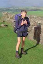
It's been one of those rare days today where l haven't got lost and had to back track. I left Flaxpool about 7:30am, after chatting with a group of walkers who were walking the Macmillan Way. It was overcast all day, especially when l climbed above the 300m mark. l think l was just walking in low cloud. I made my way on very quiet minor roads all day. A good route in that respect.
I went via Tolland to Brompton Ralph where l got into conversation with two ladies, one whose day it was to work in the shop. The shop was closed but she very kindly opened up to sell me food and drink. It was the only shop l passed between Flaxpool and Wimbleball Lake, the downside of todays route.
From Brompton Ralph l followed the route to Clatworthy and along past the reservoir to eventually reach Wimbleball Lake by 1:30 pm. At 6 hours l think that is my shortest day.
There is a good little tea room beside the lake which also acts as reception for the campsite. I started with steak pastie and tea followed by a walkers cream tea.
There is a pub within about a mile and a half at Brompton Regis and l will head there for my evening meal . Breakfast looks like being nuts and chocolate as the cafe doesn't open until 11:00am.
Hopefully my wife will be getting a hire car tomorrow and so l will no longer be constrained to picking a route defined by campsites. For example the day that originally went via Thurdon may be re-routed via Holsworthy. I just make this point in case anyone is thinking of meeting up with me. I'll try and blog any revised route beforehand. However some places, like Wimbleball Lake have no cell phone coverage. A quiet day and it looks like another quiet day tomorrow.
Update:
As my left big toe rubs in my boot l decided to go to the pub in Brompton Regis in my crocks. I also decided to choose the shortest path, over the fields, to the pub. The good news is my navigation was spot on. The bad news is the path was extremely boggy and really required boots and gaiters, but only over a relatively small section. The upshot was I had to sit in the pub with very wet feet.
Then I decided to return via the road that included a short cut up a bridleway. It was only around 8:00 pm but it was getting dark, especially under the trees. I came to a junction which wasn't shown on my map and this threw my junction counter out of kilter. Although l didn't know it at the time, l was going up the road to the west of King's Brompton Forest having taken the left instead of right turn. I could see the lake so knew which direction l wanted to go but it was too dark to read the map. I thought l would be back before it got dark and hadn't packed my head torch. Big mistake.
I decided to take a short cut across the fields but was blocked by the forest. However l saw car headlights on the road and made my way down to them where by luck l picked up a path to the road. It's obvious when you can see a map but very difficult in the dark. I stopped a car, that was coming past, to get directions to Wimbleball Lake and they said they were going there and would give me a lift. In the event l was back on the correct route and only 400m from the turn to the lake but without being able to see the map l had no idea.
I'd just like to thank the couple for the lift, as walking beside the road in the dark would have been quite unpleasant.
About my blog
CLL is the acronym for Chronic Lymphocytic Leukaemia. CLL is the most common cancer of the blood. However, unlike many other leukaemias, CLL is incurable. Innovative research is desperately needed to provide treatments which are more effective than the derivatives of chemical warfare agents currently in use. Research however costs money.
In 2009 I walked from John o'Groats in the north east of Scotland to Land's End in the south west of England. Hence the acronym JOGLE. The purpose of my walk was to make more people aware of this insidious disease and to encourage them to sponsor me by donating to the research groups I was supporting. It was a most enjoyable experience and I met some wonderful people. Together we raised over 2000 pounds for the cause. Thank you everyone!
In, 2010, the blog was being continued for those who may have be interested in following my walking holiday in Wales. This was not a charity walk.
Sadly this year, 2013, Alan Frost, a senior member of the Wednesday Loafers, our cancer support group, passed away. Many medics will tell you that CLL can be cured by a bone marrow transplant. Alan had battled with the cure for many years. More research is needed, but significant progress has been made since I started this blog.
CLL is still killing my friends. The organizations listed at the side of this blog would welcome any contributions you would like to make towards their research.
Please feel free to pass on the details of this site to anyone you think may be interested. The link is www.cancerwalker.com
_______________________________________________
_______________________________________________
Subscribe to:
Post Comments (Atom)
No comments:
Post a Comment